I shall be quoting from William Dicey Borderline, Kwela Books, 2004.
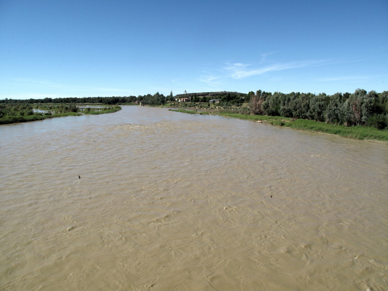
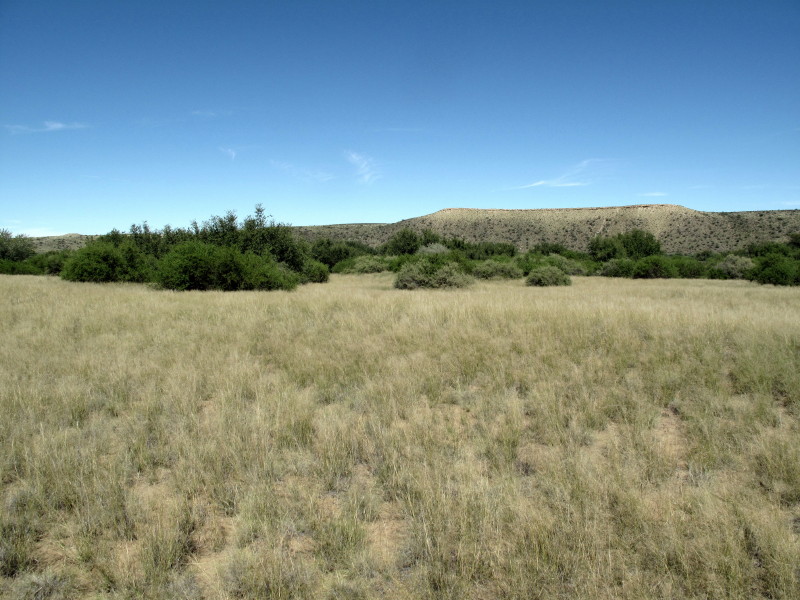
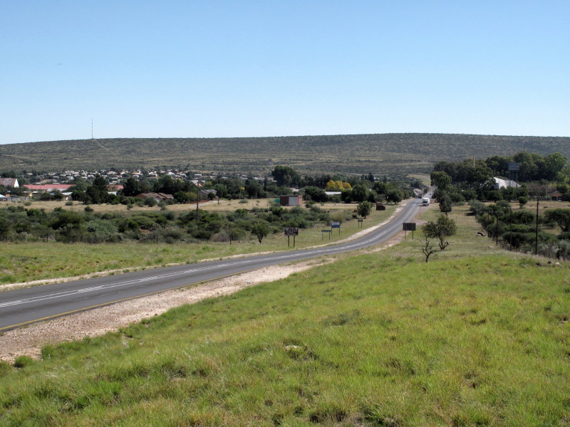
This town’s claim to fame is it is one of the places you can cross the Gariep river but they absolutely ignore the river – the chief feature in the locality. Prieska is just behind the scrubby trees along the bank of the Gariep on the right of this picture.
I found a little track to the riverside close to the bridge.
I had to ride through an unofficial dumping site to get to the Gariep. There is Die Bos on the other side of town. It was a braai and relaxation area under the trees alongside the river. I went there to have a look but didn’t stop as some people are squatting there making me feel quite threatened.
Imagine if there was an imaginative town council years ago that had decided to make something of the river frontage. If the main shopping street had been set some way back from the river so that there was a treed & grassed area all alongside the Gariep with benches and braai places as a community space alongside the main commercial center with views of the river. There is a majestic and gorgeous river right there but they ignore it.
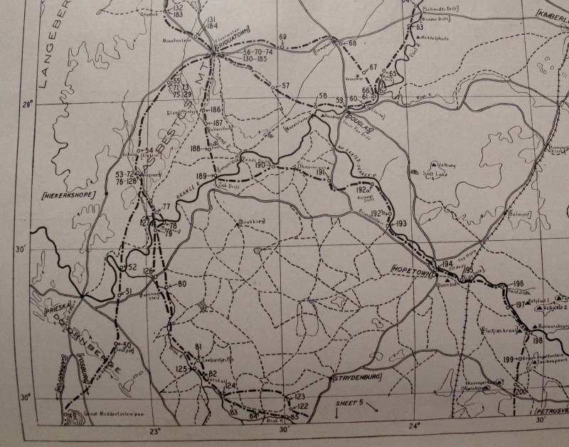
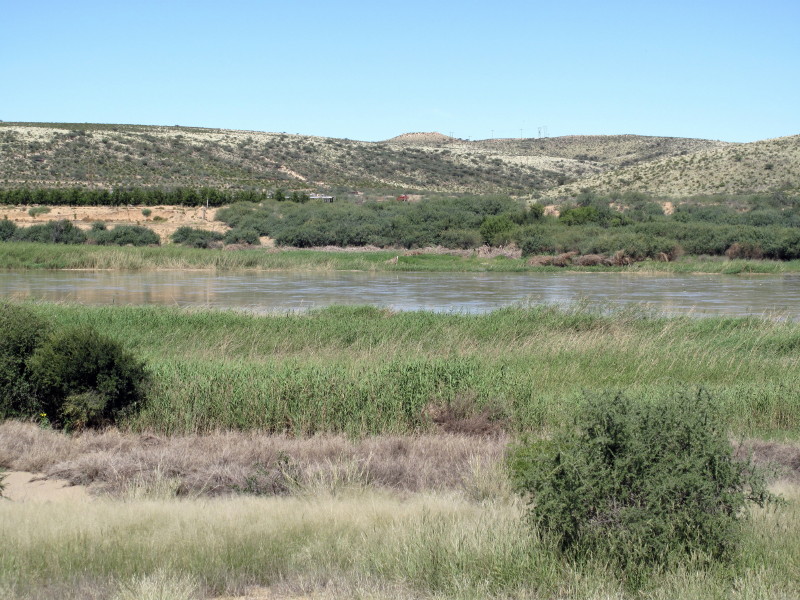
Burchell crossed the Gariep (he called it that too – never Orange. It was the original name) slightly upstream from Prieska at a big loop in the river. Here is map #4 of the McKay maps (which helped me so much) showing Prieska at the lower left. The river is shown by the thick solid line. Burchell’s track is the chain dotted line with numbers for each night’s stop (the numbers only increase again when he moves on so they record his travel days only). #52 is where he crossed the Gariep the first time and is the place I was looking for this day. (The town with five tracks radiating out of it towards the top left is Griquatown {Griekwastad}; known as Klaarwater when Burchell was there.)
I tried firstly from the south side where map #2922 & Mapsource show a very minor road but it was locked. I then went over to see if I could get to it from the northern side. I was very lucky to find the gates open to the big farming operation alongside the river (it was Sunday).
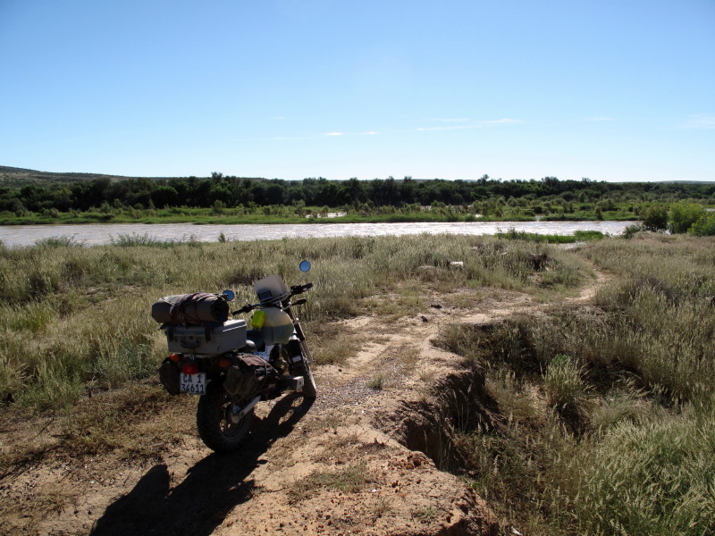
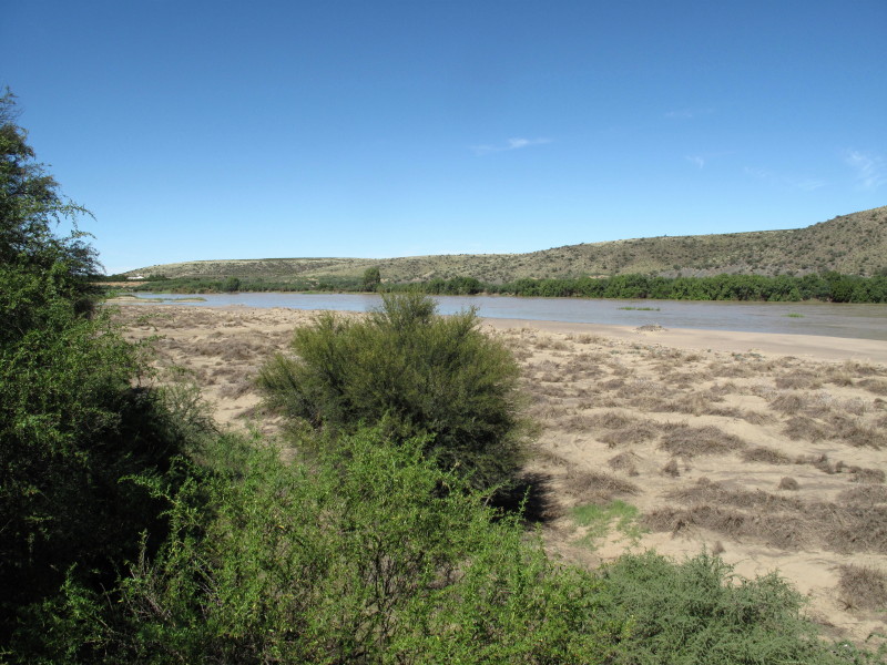
I went round & round the side of interlinking pivot irrigation circles. I had the Zumo on a small scale but the sun showed which way to go & there was no one to chase me away. The irrigation stops short of the river (flooding?) so I had to walk the last bit to see what it looked like. The river is on the far side of the trees against the hillside.
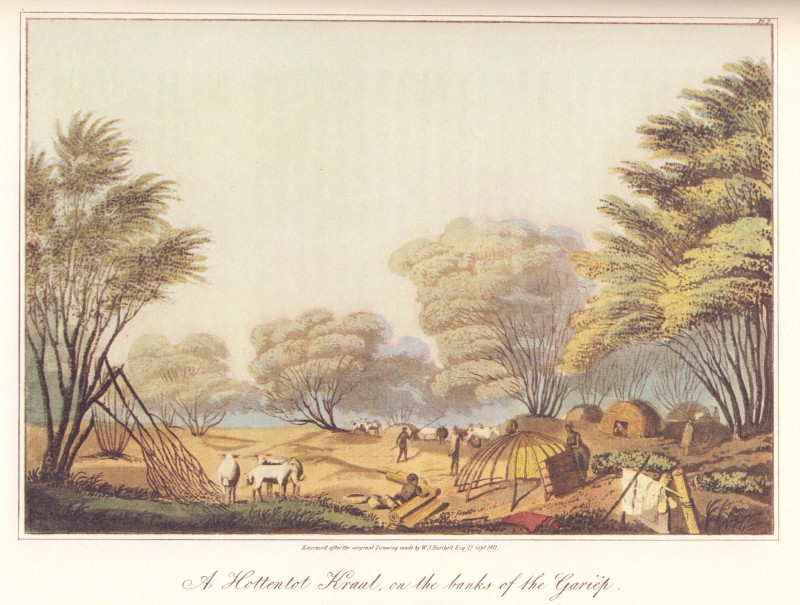
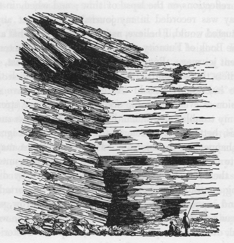
Here is Burchell’s picture (from the other bank).
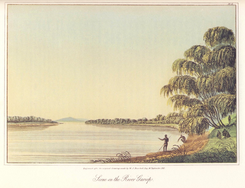
Burchell’s description:
The water glittering under a fervid sun, caught my eye through the leafy screen; and a few steps lower, opened as enchanting a view as it could be possible for fancy to imagine. Whether the feelings of an enthusiastic lover of scenes of nature, may have influenced my judgement, I cannot say; but still I think that, whoever shall visit the banks of the Gariep, and not feel both delight and admiration, must be cold indeed, and very deficient in taste or sensibility. The first view to which I happened to turn myself, in looking up the stream, realized those ideas of elegant and classic scenery, which ate created in the minds of poets, those alluring, fancies of a fairy tale, or the fascinating imagery of a romance. The waters of the majestic river, flowing in a broad expanse resembling a smooth translucent lake, seemed, with their gentle waves, to kiss the shore and bid it farewell for ever, as they glided past in their way to the restless ocean; bearing on their limpid bosom the image of their wood-clothed banks; while the drooping willows leaned over the tide, as if unwilling to lose them; and the long pendent branches, dipping their leafy twigs in the stream, seemed fain to follow. Here I could have rested the whole day; here I could have fixed my abode for months : enjoying the delightful shade, and inhaling the refreshing air. Rapt with the pleasing sensations which the scenery inspired, I sat on the bank a long time contemplating the serenity and beauty of the view.
Having seen what it was like I was able to ride across to the river.
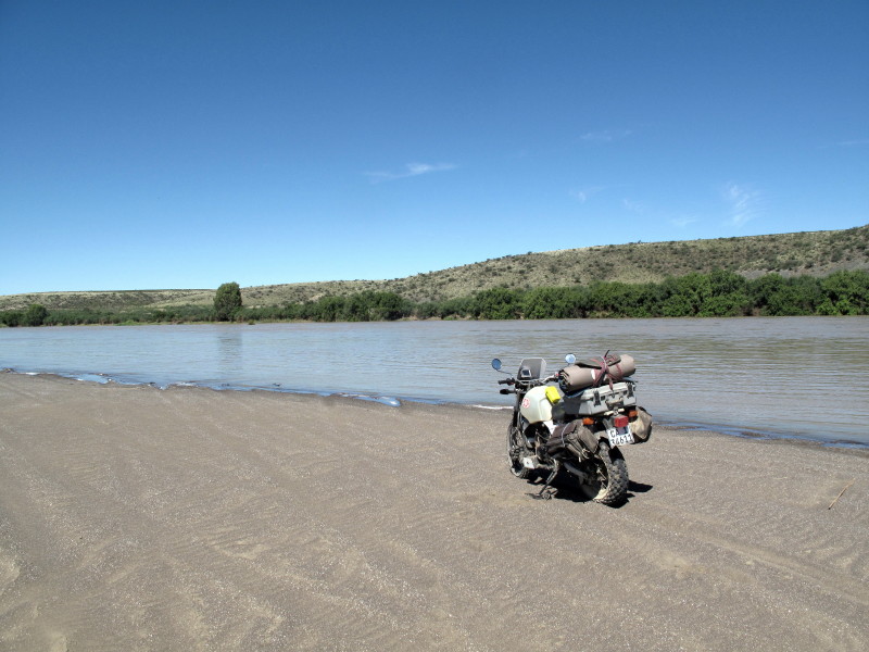
I would think that he actually crossed slightly upstream where the opposite hills are lower. Here.
Burchell describes the crossing:
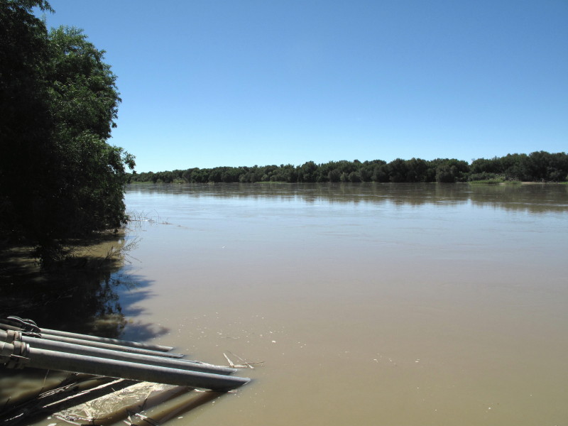
In three hours we again approached the river, and arrived at the spot distinguished on my map by the name of Shallow Ford. While the rest were engaged in levelling the road down the bank, and exploring the safest part of the ford, I made a sketch of the river, from the top of the high woody bank, whence there was a broad, and far-extended view up the stream; the smooth water, like a polished mirror, appearing divided from the sky, only by a narrow blue line of distant hills. Here the southern shore was defined by naked cliffs; while, on the opposite side, a continued belt of willows and acacias extended, gradually diminishing in the distance, till, turning round a low projecting point of land, it entirely disappeared. The waggons being all assembled, several men, some on horse¬back, and some on oxen, were the first to enter the river, not only for the purpose of pointing out where the water was shallowest, they having been twice across during the morning; but to give warning to those who were behind, if by chance a hippopotamus hole should be found in their way. They were followed immediately by the train of waggons, each with a steady leader at the head of the team, to restrain the oxen from turning down with the current, which they are very inclined to do, when left to themselves. As one waggon plunged into the stream, another descended headlong down the steep bank, closely followed by another; and as these moved on, others in their turn advanced from the rear, till the line, stretching entirely across the river, seemed like a bridge of waggons. The train at first took a very oblique direction downwards, till they had reached the middle of the river, and from that point, proceeded directly across to the opposite side. The bottom was found to be full of large pebbles, and the greatest depth no more than two feet and eight inches; but the current was therefore very rapid and strong. The water was quite transparent, a proof that no heavy rains had lately fallen in the upper part of its course. At the ford the surface was smooth; but lower down, and in sight, it was broken by a fall of about two feet. Each waggon took a quarter of an hour to perform the passage, which might be estimated at a little more than a quarter of a mile. The oxen were driven through by about a dozen Hottentots ; and as many were required to swim the sheep and goats over in safety.
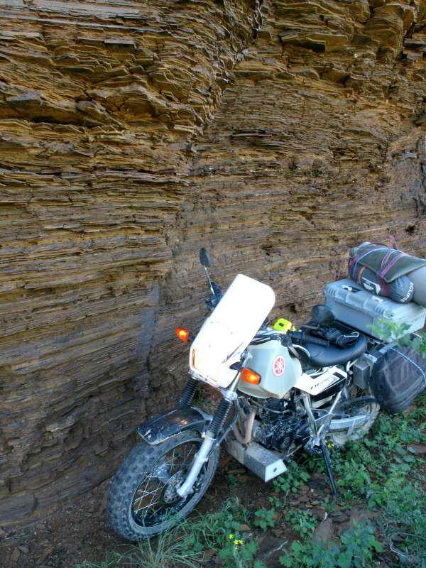
The river was quite full because of all the water being released from the Vaal Dam. The trees on the side I had access to are not as big. If you look back to the photo of my bike beside the river you will see that the trees on the far bank are much bigger – just like they are in Burchell’s picture.
This picture is further upstream but it looks more like Burchell’s first picture.
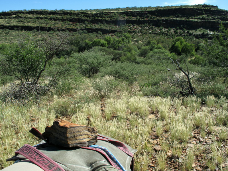
Burchell then went on to Klaarwater (Griekwastad) as he was travelling in convoy with some of the missionaries and their followers. At one time I was involved in the semi-precious stone business. Tiger’s eye comes from around Niekerkshoop in the asbestos mountains and I wanted to see it. I had plotted a route along a very minor dashed track in Mapsource (not in T4A) which turned out to be exactly the correct track fortunately as it took me right through the tigers eye workings. Burchell had seen the tiger’s eye, describes it & includes this picture of the blue tiger’s eye he saw.

This is a piece I picked up when opening one of the gates on the track. The cliff in the background shows the outcrop of thin layered sedimentary rock that forms the Asbestosberg. Tiger’s eye is formed by the replacement of the asbestos fibres by silica; *Wiki*
*Here* is a link about tigers eye including a video of them mining without any power tools.
I rode up to be next to those rocks:
Very similar to this engraving.
Small though the road is marked it turned out to be very nice through the hills, you cross a game farm at one stage.
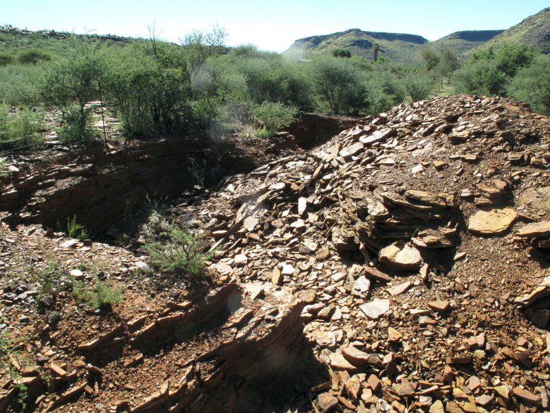
Then you come to one of the tiger’s eye mining pits, just like the one in the video I linked.
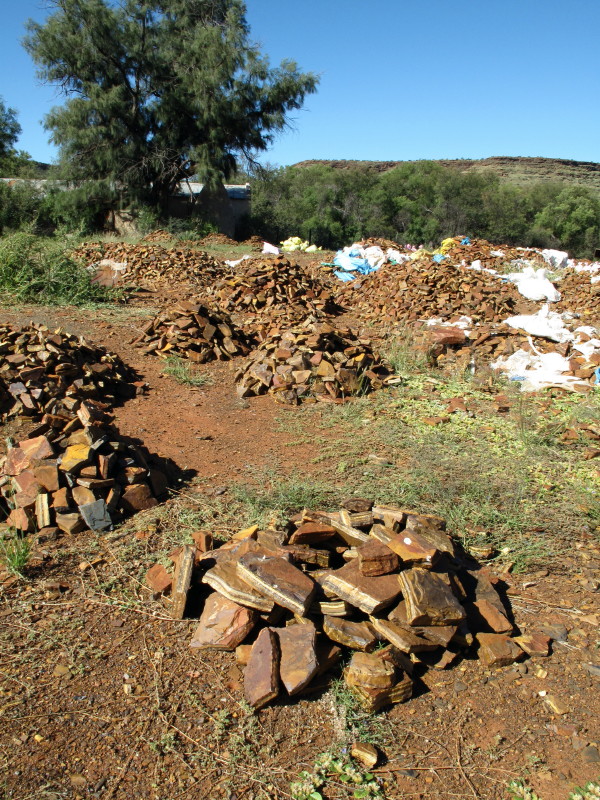
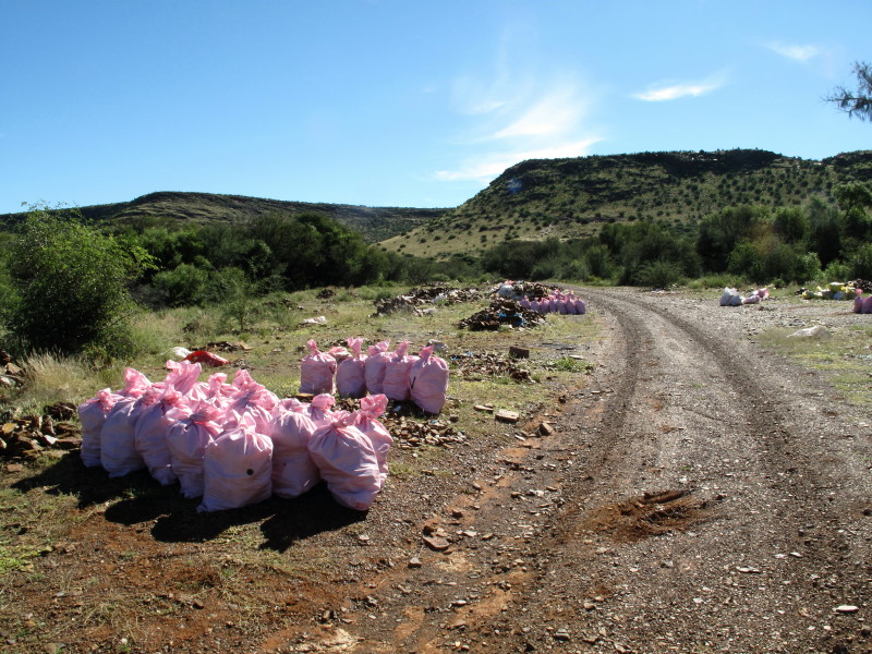
A little further on I came to this sorting and bagging area on the track.
There was nobody there on a Sunday.
This is the village called Kloof by Burchell (1:238). Map #2922 shows that the farm is now named Kloof in the same place & it is on the route I took to see the tigers eye.
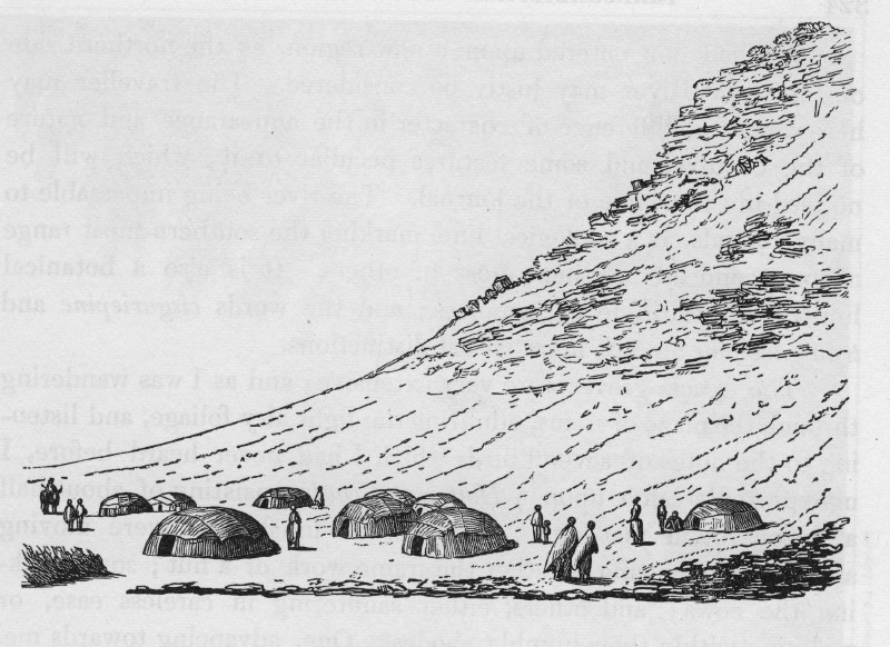
Those are traditional Khoi matjieshuise – reed mats on a frame of poles stuck into the ground.
Those ore bags of sorted tigers eye with the very same hillside in the background.
The missionaries had to socialise here as this was part of their community and they had been away for some years (1:328). The next day they went on to Klaarwater (Griekwastad). Burchell’s big fold out picture is too big to show properly here. Not much of a town then.
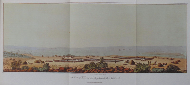
My picture; not much of a town now:
And from the opposite side.
Griekwastad does not even have cell phone reception let alone a decent shop. There is a crappy bar & an hotel I was advised to avoid. My thoughts were no different to Burchell’s (1:352]:
My disappointment in the appearance of the place arose from expecting, perhaps, too much.
The missionaries were working with the Griekwa. This is how they are defined in Wikipedia:
The Griqua are a racially and culturally mixed people who originated in the intermarriages or sexual relations between European colonists in the Cape and the Khoikhoi already living there in the 17th and 18th centuries.
The community has a truly amazing history; 2000 trekked of under Adam Kok 3 to create Giqualand East with Kokstad as the main town. They went through Lesotho crossing the Drakensberg by the spectacular Ongeluksnek Pass. There is an exceptional website about them http://www.tokencoins.com/griqua.html - it is a very chaotic site. I found the next picture there some time ago but it took me 40 minutes to eventually track it down again.

*Source*
Burchell’s picture of the mission. Church at the front, a missionary’s house at the back with a store room between.

Seven years previously they had started to build a stone church. There is plenty of lovely flat stone lying around so it was hardly difficult but they lost interest when at shoulder height (1:367). Seems like the missionaries were too feeble to get them to continue.
The house Mary Moffat grew up in (David Livingston’s wife). Built out of the abundant local stone.
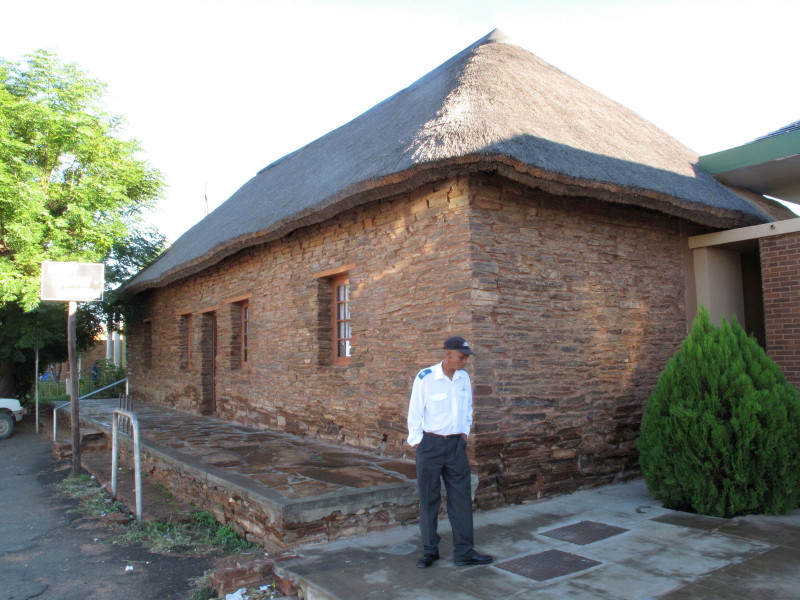
The old mission house, built roundabout 1828, today houses the Mary Moffat Museum. When Griquatown was laid out as a town in 1879, the survey commenced from the mission house, the parallels being taken from the front walls of the building. In 1904 this house was sold to Barclays Bank, who purchased the property directly from the London Missionary Society, and up to 1956 used it as a bank. When Barclays Bank completed their new building next door, the building was converted into a museum. Dr Robert Moffat and his wife Mary, waiting to depart to Kuruman resided at Griquatown when their daughter, Mary, later Mrs. David Livingstone, was born in Griquatown in 1821.
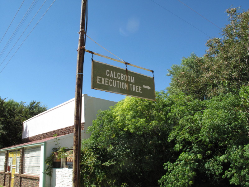
*Source*The famous "execution tree", where Waterboer hanged stock thieves and murderers, can still be seen but when I looked into the yard where it is signposted to be the trees that I saw looked far too young and small. I did not have time to investigate properly.
Here is a fabulous story about when a steamboat passed through the town. (Dicey 47)
Here the steamboat, which had travelled upstream from the Orange River mouth, turned north up the Kuruman River and sailed on to Lattakoo, the most northerly of the Cape mission stations. The steamer's progress was not hindered by the fact that Klaarwater, today called Griquatown, is fifty kilometres from the river, nor by the fact that the Kuruman River flows into the Molopo, which only joins the Orange below the Augrabies Falls, nor indeed by the fact that the Orange is unnavigable. For The Queen and Czar steams her way through Meridiana: the adventures of three Englishmen and three Russians in South Africa (1872), a little-known novel by Jules Verne. The six foreigners of the title are astronomers, come to measure an arc of the meridian in southern Africa. They have the obligatory run-ins with hippos, crocs, elephants and lions before fleeing the assegais of a native horde with the scientific results they have risked their lives for. Remarkably, they find a river that carries them from the central Kalahari to the Zambezi and on to the Indian Ocean. Meridiana, along with better-known works such as Around the World in Eighty Days, is one of fifty-four novels by Verne collectively known as Voyages Extraordinaires.
This prodigious output explains, perhaps, why Verne didn't let geography stand in the way of a good story. The real story of Klaarwater, though, proves far more compelling than his fiction.


.
No comments:
Post a Comment