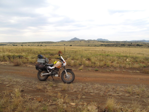
I wanted to see the Vanderkloof dam. It was overflowing. Not the biggest dam in the country but it has the highest dam wall.

You can simply drive across the wall. I was surprised as I had expected it to be closed off.
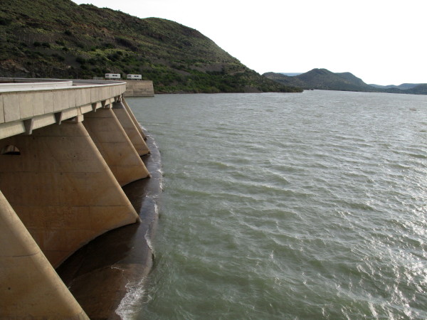
Looking up the lake.

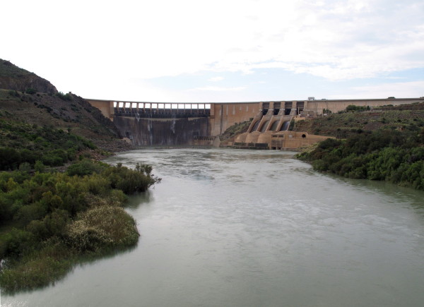
Looking downstream.

As much water flows through the turbines here as at the Gariep Dam (previously H.F.Verwoed). I was surprised that I did not see a strong current coming out from the turbines (left corner of the picture). The electric cables are not very big (left of picture); not nearly as much hydro electricity generated as i had believed. From *this good site* I see it can make 240MW. That is just 5% of the 4800MW that the new Medupi station will produce.
View from the road bridge.
Next town is Philipstown which is part of De Aar. The ratepayers have laid a criminal charge against the municipality. If you accept payment for something and then fail to hand that thing over it is fraud which is a criminal offence.
Upington – The municipality of Philipstown in the Northern Cape could be the first in South Africa to face charges in a criminal court due to poor service delivery. Fed-up residents recently laid two charges of fraud against the Renosterberg municipality with police; Philipstown is part of the municipality. According to the Philipstown Ratepayers Association, this drastic step was taken after residents could no longer watch the collapse of the town, which allegedly started when the ANC took control of it four years ago. The municipality, which is situated about 55km from De Aar, could collapse within one month as it, among others:
• Has no money for fuel for service vehicles
• Has no money to buy bulbs for street lamps
• Has no firefighting services
• Regularly cuts the town’s water
• Allows potholes to worsen and does not look after historic buildings
• Does not pay its electricity account
• Has no welfare services
The municipal manager said, however, that service delivery was a priority and that the ratepayers were being racist. Municipal manager Mzamo Mtubu said there was an action plan to fix matters at the municipality. He said faulty accounts had been sent out due to a new computer system. He admitted that the municipality, like many others, had financial problems.
*Source*
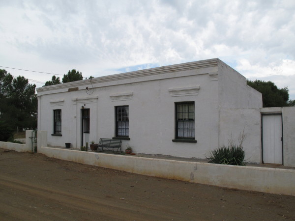
I like our undiscovered country towns with their original simple buildings. In most towns the buildings have been redeveloped or replaced so that the town has lost its original character and the original buildings that remain are isolated in amongst modern looking houses. Philpstown is an exception as the houses are all still pretty much as they were. I would have liked to spend more time photographing the village.
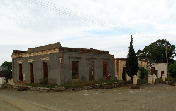
Unfortunately quite a few are unoccupied and collapsing.
Something I wanted to see was van Plettenberg’s Baaken. I learned about it from Nigel Penn’s book The Forgotten Frontier about the conflict between the trekboers and the San. Governor van Plettenberg wanted to establish a fixed line for the trekboers to extend up to and leave the territory beyond that as a no-go zone to be utilised by the San. He came all the way out here and erected a baaken to mark north-eastern corner of the colony in 1778. The San promptly flattened it (Penn page 133). He also shot 23 hippo in the Seacow River. Sadly I could not get to the actual beacon as it is on Quaggasfontein game farm . This picture is not the closest I got but it gives a better idea of the locality – at the top of the grassy hill.
In Googling for stuff about the baaken I came across this which illustrates the problem van Plettenberg was trying to overcome (Gordon guided the van Plettenberg party)
The story of an ambush led by Adriaan van Jaarsveld in 1775 which Gordon relates: “We saw the skulls of several ‘Hottentots’ (Bushmen) who had been shot by a commando two years ago. They were unable to catch the wild people who crossed the river with stolen cattle, moving on further. The farmers shot some hippopotamus and made as if to return home, travelling back a few hours, whereupon the unhappy creatures came back for the remains of the hippopotamus and about 240 were killed. The farmers say, however, that it was they who first began to shoot at them with arrows.”
*Source* The road was wet and pretty slippery so I changed plan & did not retrace back to the Hanover road I had been on but continued to Colesburg to get onto the tar road as I wanted to get to Graaff_Reinet that day.
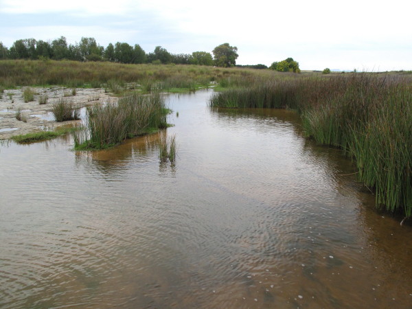
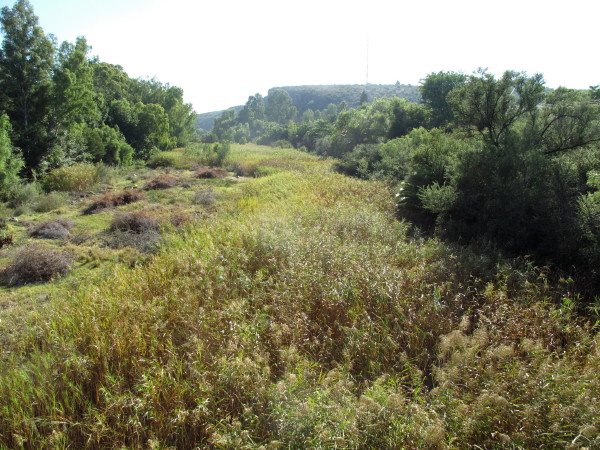
This is all there was to the Seacow River. For van Plettenberg & party to have shot 23 hippo it must be much deeper nearby. The river formed the main wagon route from the Eastern Cape up to the Gariep River besides marking the eastern border of the Cape Colony. Difficult to believe what looks like such an insignificant stream was used to mark the eastern boundary of the colony.
I went through Colesburg and on to Noupoort; famous for its brutal drug rehabilitation centre. It used to be a very important marshalling yard during the days of steam locomotives so there are a lot of old railway houses. Next Middelburg (named because they established a town in the middle between Cradock, Colesburg, Richmond, & Hofmeyer) I took this nice gravel road that passes through the neck between the hills ahead but ended up chasing the rain to get off it before it was even more slippery than it already was. We both got to the end of the road at about the same time. I suited up & carried on to Graaff-Reinet in the rain most of the way.

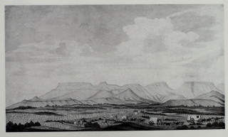
I posted this picture of Graaff-Reinet by Burchell in the Cape Mountains post. It shows that there was not much in Graaff-Reinet in 1812.

Burchell says there were 74 houses but that just seven years before there had been only 15 or 20. It was growing rapidly. Besides three blacksmiths, wagonmaker, butcher and baker there was a pagter = bottle store (2:145). So the town was attending to priorities but that shop captured all the money Burchell’s men had before they left (2:152).
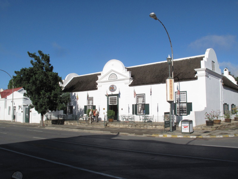
The Drostdy is still there.
The town has the church at the head of the main street as usual. This is the third (?) church on the site. Lots of money spent making it very ornate on the outside. To me it looks like the sort of wedding cake Sol Kerzner would select. I much prefer buildings with strong design elements and little decoration – plainly handsome buildings.

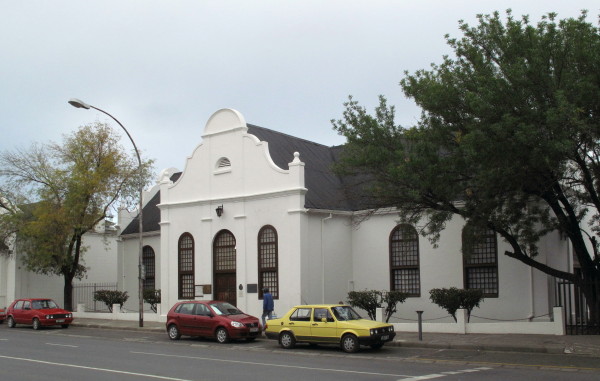
Graaff-Reinet is well known for its prestigious ‘Cape Dutch’ buildings. This is the Hester Rupert Museum. Quite a restrained building. It was built as the Dutch Reformed Mission Church serving the Coloured community who vacated it due to the Group Areas Act. I did not go inside.
Total wanted to demolish the old slave church in Graaff-Reinet to make way for a garage. Anton Rupert intervened personally, offering to buy back the church from Total. He took the matter to their head office where he resorted to some gentle blackmail when he realised that he was getting nowhere. He apparently suggested that it would be a shame if all the hundreds of Rembrandt reps on the road those days never filled up at a Total station again, and that sealed the deal! Today the old slave church is the Hester Rupert art museum, named after Anton's mother. The story is told in his biography, published a few years ago, so I would imagine that all matters of sueing will be sorted out by now!
*Source*Urquhart House, another of the old buildings that has been restored. The gable was cut off during Victorian times when the then fashionable corrugated iron roof and veranda were fitted during ‘refurbishment’. Houses Victorian furniture & has a peach pip floor. I am very pleased that gable and facade has been restored. I did not go inside.
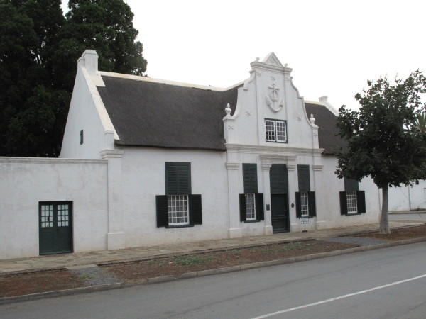
This is the Reinert House Museum which I did go to.
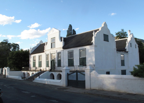
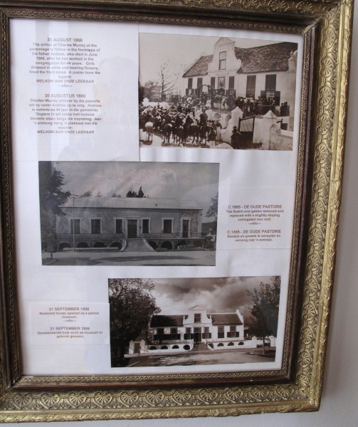
Built 1805 as the pastorie for the predekant of the church. It has a watermill which is what attracted me to it. Inside is this picture showing what happened during the Victorian period when gables and thatch were out of fashion but corrugated iron and no shutters was the height of fashion – it is difficult to recognise that it is the same building. The same thing was done to Urquhart House, this was done in 1885. That is what regularly happens when developers ‘renovate’ houses today – what they actually do is transform them to what is currently in fashion. It was properly restored in 1956 (pretty early during the revival of appreciation of Cape gables). In 1980 the place burned down so what is now here is largely a replica. Inside it is laid out as a functioning house so you see bedrooms, voorkamer, kitchen and laundry with lots of furniture and stuff that would have been in such a house.
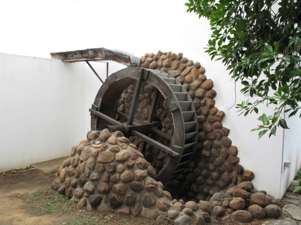
It is actually a replica and those stones look terrible. They did not have cement in those days and I hope they would have built something more handsome than that abortion. A waterwheel and mill are pretty simple machines.
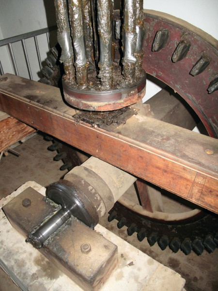
The waterwheel drives the square shaft at the back in the picture. The large crown wheel has hard wood teeth driving the iron rods of the lantern pinion. Notice how worn the iron rods are but the wooden teeth still look new. The advantage of the wooden teeth is they could easily be made locally and replaced as they wore out. Cast iron may last longer but what happens if it wears or suffers an accident? The grindstones are above driven directly by the pinion shaft (no more gearing to increase the speed). There is a hopper above for the wheat. Someone has to carry all the sacks of wheat up to the hopper; this lovely set of stairs is used. The rise and reach of the steps gives the easiest stairway to climb – much appreciated by that man I hope. If you go there try them yourself.

There is an old ox-wagon. I took photos of it because it seems to have four wheel steering. White Stripe’s father has made a lovely scale model of a Voortrekker wagon with four wheel steering – he showed it to me. Unfortunately I took photos of the front axle which clearly shows that end but I did not take decent photos of the back axle mounting. I now have a copy of the Swellendam Museum pamphlet on a Kakebeen wagon & I think this one is like that too. I now want to go to Swellendam & Genadendal where good Kakebeen wagons are and check exactly how their steering works. I will post this:
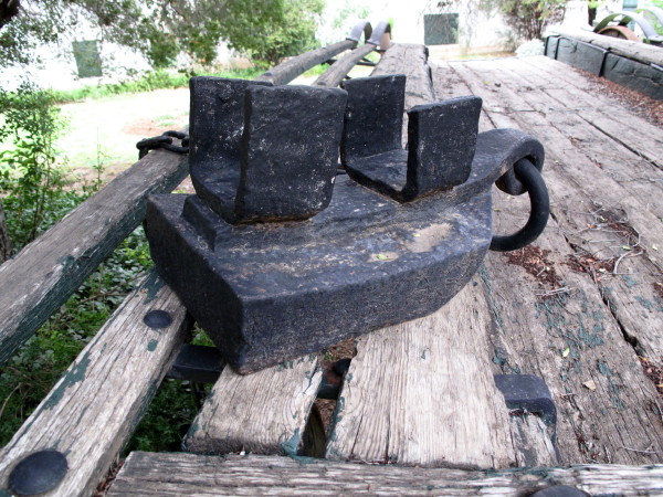
This is the brake for use on steep declines. An iron shoe that is fitted under the wheel so the wagon slides downhill on it – it is chained to the frame of the wagon. That is where the name brake shoe comes from; it persists in drum brakes even though it looks nothing like a shoe.
To tie this into Burchell here are two drawings he made of his wagon.
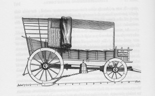
That picture shows the connection between the front and back axles which can be made to steer the rear wheels. It also shows a brake shows a brake shoe in place.
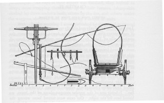
That is a wooden brake shoe in the picture. The lever at bottom left is the hand jack for lifting the wagon to grease the wheels. The pegs in the yoke are jukskeis. We can add draughtsman to the list of his abilities.
There was this:

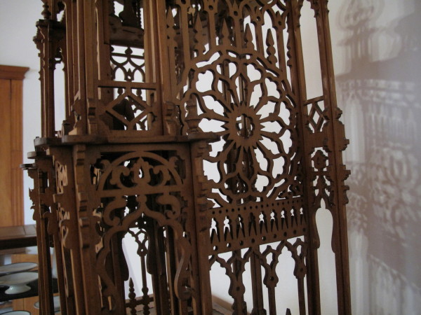
I know about houses and sailing galleys built out of matchsticks. Mr H. Joubert (1834-1897) made one out of porcupine quills. There are 52 windows with curtains; he used 40 000 pins. Good for him, I am pleased it has survived.
There is this fretwork model of ‘Big Ben’ (Big Ben is the name of the largest bell of the Westminster Clock). Made by Mr du Toit in 1902. I have been up the tower to look at the real clock. A wonderful bit of hand fretwork but it certainly is not a replica of the Westminster Clock tower. The model has an onion dome and other embellishments that are not on the genuine article.
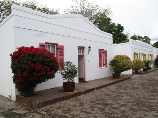
Those are some of the prestigious buildings of Graaff-Reinet. I much admire those sort of buildings but I also very much like the simpler buildings from the same era. Behind the Drostdy Hotel is a lane of restored ex labourers cottages now called Drostdy Hof. It was originally named Stretch’s Court after the man who built it c 1840 for freed slaves. It has been over restored so the buildings look like reproductions not originals. Bo-Kaap is fun, this is dull by comparison = dead. I will show some old cottages in Grahamstown that are in superb condition that have been restored very sensitively.

They are now the rooms for the hotel. Some are free standing cottages like this.
Others are semi-detached.

Inside you have a bedroom.
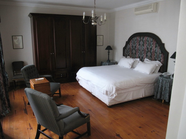
And sitting room with period furnishings.

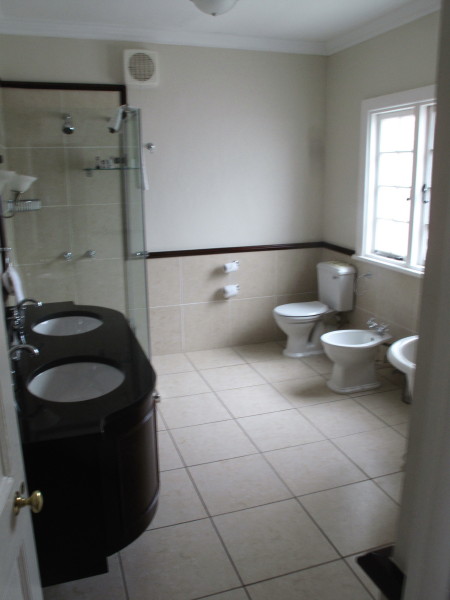
Bathroom.
I last went to Graaff-Reinet before I developed an interest and appreciation for old buildings. I now realise that I must spend time there as the whole town is in beautiful condition with street after street of little houses more or less unspoiled by the passage of time; i.e. not refurbished like what happened to Reinet House and Urquhart House.
The town is built inside a big loop of the Sundays River but it is very overgrown. They could make a really nice feature of it if the wished.
I mentioned the alarmist rumour in Graaff-Reinet before Burchell arrived in the Karoo posting thus ‘Graaff-Reinet was placed on a war footing as it expected to be invaded by 300 Klaarwater Hottentots led by a white man (2:136). The party was, in fact, Burchell plus 6 Klaarwater basters, a San youth & a Tswana man (2:15). Such was the suspicion, false information, exaggeration and paranoia amongst an ill informed community.’ The first boer they met was highly suspicious of them (remember that no European or Baster had travelled from Klaarwater to Graaff-Reinet before them) and cross questioned them in a hostile manner (2:106). They come to another farm the following day where the man was away on commando for three months but the wife made Burchell & his men very welcome (2:112). Two days later a group met up with them who had been sent out by the local veldkornet because he had heard about this party of invaders. He was highly suspicious and left very quickly to report back (2:127). When they were about fifteen km from Graaff-Reinet they were met by an armed party sent by the landrost to ascertain what was going on. Burchell had letters from the Governor instructing all officials to assist Burchell. On seeing this these men changed their attitude and sent back a written message to the landrost. Burchell had a fever (flue) at the time and was lying in his ‘bed’ in the ruin of an abandoned boer's house. Next thing the landrost sends the dominee’s horse drawn carriage to collect Burchell (the only carriage in Graaff-Reinet) (2:136).
I recounted his troubles recruiting labour in Graaff-Reinet in the post about the labour recruiting trip so will not repeat it.
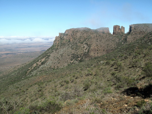
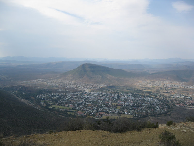
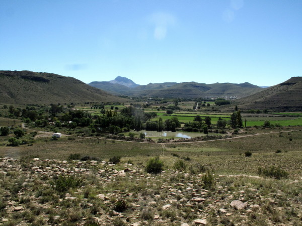
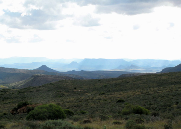
Burchell came down to Graaff-Reinet on a horse to recruit men for his journey beyond Klaarwater (Griekwastad). I wanted to go out to Nieu-Bethesda looking for the site of some of his pictures and, more particularly, those of Schumacher painted in the area (there are quite a few). I went up to the Valley of Desolation. On WD Wolweseun posted *this report* of his trip which has exceptional pictures of it and Nieu-Bethesda. This is my picture.
This is just one of the lots of pictures in his report – all of which are so much better than mine – showing Graaff-Reinet with the Sundays River curving round it.
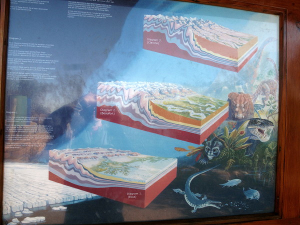
I posted about the geology of the Karoo based on two books I have. I was very interested to see the brilliant diorama about it in a display board there. It explains how the rock & mountain formations visitors have been looking at came to be. It is behind glass & I didn’t have a polarising filter so the reflection kills the picture. My whole post all in one poster – excellent. This is most of the first half of the poster.
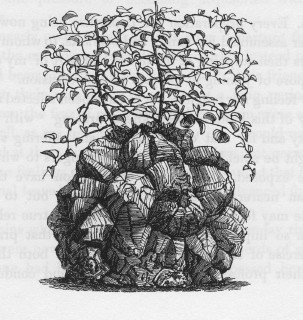
I never saw this although I kept an eye out. Burchell calls it Hottentot bread. I searched Google using that & found what I was looking for.
Burchell’s father was a prosperous nurseryman (1:i7). William had Linnaeus’s System of Botany as a schoolboy. After he finished school he did not go to university but worked for his father and continued with his botanical studies at Kew Gardens. In 1803 he was elected a Fellow of the Linnaean Society of London (1:i7). He was particularly interested in the plants on his travels returning to London with 60 000 specimens most of which were plants (1:i11). Here is his entry for this plant (2:147):
Being a botanist he then has to give a formal description which he does as a footnote in the required Latin:
I have cut the Latin short as in this instance he is actually repeating what someone else wrote but his book has similar formal Latin descriptions of each new plant he discovers.
Besides its fascinating looks this plant is interesting because it is a natural source of cortisone. It was almost exterminated by exploitation which, fortunately, stopped when cortisone was synthesized.
Here is a description from an American site where you can buy the seeds.
Another good reference http://www.plantzafrica.com/plantcd/dioscoreleph.htm
Another reference confirming that Burchell was correct when he wrote that it was a member of the yam family http://web.uni-frankfurt.de/fb15/kahl/pdf/Vendl_2006.pdf
We can add botanist to the list of Burchell’s qualifications.
Continuing in this theme. Here is his drawing of a soetdoring to show how well he could draw a plant.
As another example of his skilled botanical drawing here is the Grapple Plant seed Uncaria procumbens (1:536) called Duiwelsklou.

*This reference* has a picture of the seed showing how accurate it is. *This reference* is CITES stating that it needs protection because the tubers are being dug up and sent to Germany where it is used to make medicine.
The medicinal uses of H. procumbens are numerous, it is used for the treatment of arteriosclerosis, gastro-intestinal problems, diabetes, hepatitis, and neuralgia. It also shows some indications for reduction of spasmodic blood pressure as well as positive effects on liver, gallbladder and kidney diseases (STÜBLER 1987, VOLK 1964, WATT & BREYERBRANDWIJK 1962, WENZEL & WEGENER 1995). The herb has potent anti-inflammatory characteristics and anti-arthritic activity with no notable side effects (ANON. 1998).
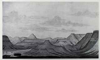
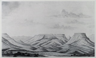
Burchell gives this picture of the pass they went through at Graaff-Reinet (on his earlier labour recruiting visit). Most of his pictures are to record what places looked like – similar to a photographic record. This is different as it is an artistic picture of the scenery. I have shown his portraits now add scenic pictures too.
Ouberg Pass (there are actually many passes with that name) is just after the Valley of Desolation and on the way to Nieu-Bethesda but it is not the same as what Burchell painted. From Burchell’s decription of it being the descent from the Sneeuberg I think it is most probably at Groot Hartebeesfontein farm on map 3124 or possibly Grootklip. Having ridden out to Nieu-Bethesda and now having a better idea of the countryside makes it easier to understand what Burchell has written.
The plaque at the top of Ouberg Pass lists T.G.Bain as one of the two engineers. Built in 1946 I wonder if he is part of the famous family that gave us the father & son engineers Andrew & Thomas.
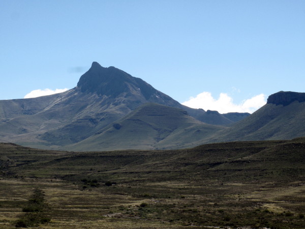
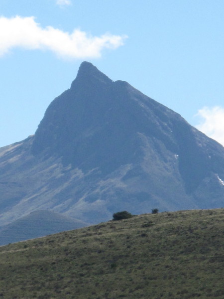
I went looking for the six scenes Schumacher did of the Sneeuberg and Camdeboo. First I went up to Nieu-Bethesda to photograph Kompasberg as Burchell has an engraving. Then I went east looking for any of the six Schumacher scenes but found none. Next time I know I should go out towards Richmond – after all that is where the Sneeuberg are!
Luckily I had my Zumo as there are really no signs pointing to it. That is Kompasberg on the skyline.
Here I made a mistake. Wolweseun shows that he had a lovely light meal at the local micro brewery but I went to some place where I waited so long just to place an order that I walked out & went to the next place that does not sell beer. I must be one of the very few tourists to pass through Nieu-Bethesda without going to the Owl House. I would very much like to see it & the crushed glass ceilings. Wolweseun posted brilliant pictures of the Owl House in *the report I linked before*, but it seemed deserted when I rode past.
Burchell writes:

After lunch I took the northern road towards the N9 (the southern one was closed – washed away?) which got me this.
This is not quite the right angle so I kept going & did get the correct view.
S 31° 50’ 51.7” E24° 36’ 47.9” but Burchell says he was 32km from it so I was in the right direction but closer (2:184). He made the sketch not on his labour recruiting trip but on leg of his trip I was now doing. I had followed his route quite accurately the day before but it was rainy and cloudy so I did not see it from 32 km away.
I then went looking for the sites of the Schumacher pictures of this area. There is an interesting gravel road that Burchell used when going to Graaff-Reinet in his wagon which follows the railway & Sondags river down towards Graaff-Reinet. I went down that until the road breaks away from the valley to join the N9 when I turned around & rode back up to the T-junction then went further east. Because I kept meeting the Sondags as I continued with this trip I have collected all the pictures into a separate post about the Sondags which I will post after the last crossing.
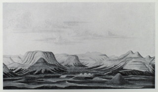
These are the seven pictures Schumacher made in this area. I suspect he rather liked the flat topped Karoo mountains – just as I do. Sadly he did not get to the glorious Kareeberg – I would love to seen his pictures of them. This one is labelled ‘View of the Sneeuwbergen at Van der Walt’
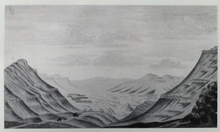
The following one labelled ‘View of the Sneeuwbergen as wild country’.
The next one is labelled ‘The Sneeuwbergen at Koeckmoer’
Next one ‘The Sneeuwbergen in Northern direction.’
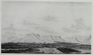
Next one is labelled ‘In the Camdebo on the farm of Johannes Swanenpoel’.
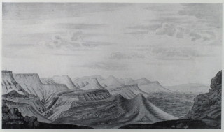
The next one is labelled ‘The Camdebo Mountains seen from the Sneeuwbergen’
Finally there is ‘Hunt for Springbuck in the vicinity of Camdebo’. It is not obvious from this small picture but the whitish dots all across the veld are springbok on one of their mass migrations.
You can see the similarity in the form of the mountains but none of my pictures match Schumacher’s. It would be an interesting project to look for them all. I went east from Nieu-Bethesda partly because of time constraints & largely due to ignorance. The Sneeuberg is north and slightly west of Graaff-Reinet and Camdeboo is west so I was looking in the wrong place. Next time I will know where to look.


.
They are now the rooms for the hotel. Some are free standing cottages like this.
Others are semi-detached.
Inside you have a bedroom.
And sitting room with period furnishings.
Bathroom.
I last went to Graaff-Reinet before I developed an interest and appreciation for old buildings. I now realise that I must spend time there as the whole town is in beautiful condition with street after street of little houses more or less unspoiled by the passage of time; i.e. not refurbished like what happened to Reinet House and Urquhart House.
The town is built inside a big loop of the Sundays River but it is very overgrown. They could make a really nice feature of it if the wished.
I mentioned the alarmist rumour in Graaff-Reinet before Burchell arrived in the Karoo posting thus ‘Graaff-Reinet was placed on a war footing as it expected to be invaded by 300 Klaarwater Hottentots led by a white man (2:136). The party was, in fact, Burchell plus 6 Klaarwater basters, a San youth & a Tswana man (2:15). Such was the suspicion, false information, exaggeration and paranoia amongst an ill informed community.’ The first boer they met was highly suspicious of them (remember that no European or Baster had travelled from Klaarwater to Graaff-Reinet before them) and cross questioned them in a hostile manner (2:106). They come to another farm the following day where the man was away on commando for three months but the wife made Burchell & his men very welcome (2:112). Two days later a group met up with them who had been sent out by the local veldkornet because he had heard about this party of invaders. He was highly suspicious and left very quickly to report back (2:127). When they were about fifteen km from Graaff-Reinet they were met by an armed party sent by the landrost to ascertain what was going on. Burchell had letters from the Governor instructing all officials to assist Burchell. On seeing this these men changed their attitude and sent back a written message to the landrost. Burchell had a fever (flue) at the time and was lying in his ‘bed’ in the ruin of an abandoned boer's house. Next thing the landrost sends the dominee’s horse drawn carriage to collect Burchell (the only carriage in Graaff-Reinet) (2:136).
I recounted his troubles recruiting labour in Graaff-Reinet in the post about the labour recruiting trip so will not repeat it.
Burchell came down to Graaff-Reinet on a horse to recruit men for his journey beyond Klaarwater (Griekwastad). I wanted to go out to Nieu-Bethesda looking for the site of some of his pictures and, more particularly, those of Schumacher painted in the area (there are quite a few). I went up to the Valley of Desolation. On WD Wolweseun posted *this report* of his trip which has exceptional pictures of it and Nieu-Bethesda. This is my picture.
This is just one of the lots of pictures in his report – all of which are so much better than mine – showing Graaff-Reinet with the Sundays River curving round it.
I posted about the geology of the Karoo based on two books I have. I was very interested to see the brilliant diorama about it in a display board there. It explains how the rock & mountain formations visitors have been looking at came to be. It is behind glass & I didn’t have a polarising filter so the reflection kills the picture. My whole post all in one poster – excellent. This is most of the first half of the poster.
I never saw this although I kept an eye out. Burchell calls it Hottentot bread. I searched Google using that & found what I was looking for.
Burchell’s father was a prosperous nurseryman (1:i7). William had Linnaeus’s System of Botany as a schoolboy. After he finished school he did not go to university but worked for his father and continued with his botanical studies at Kew Gardens. In 1803 he was elected a Fellow of the Linnaean Society of London (1:i7). He was particularly interested in the plants on his travels returning to London with 60 000 specimens most of which were plants (1:i11). Here is his entry for this plant (2:147):
These mountains are the native soil of an extraordinary plant called Hottentots Brood . Its bulb stands entirely above ground, and grows to an enormous size, frequently three feet in height and diameter. It is closely studded with angular ligneous protuberances, which give it some resemblance to the shell of a tortoise. The inside is a fleshy substance which may be compared to a turnip, both in consistence and colour. From the top of this bulb arise several annual stems, the branches of which have a disposition to twine round any shrub within reach. The Hottentots informed me, that, in former times, they ate this inner substance, which is considered not unwholesome, when cut in pieces and baked in the embers. It will easily be believed that this food may not be very unlike the yam of the East Indies, since the plant belongs, if not to the same, at least to a very closely allied, genus; as the membranaceous capsules, with which it was at this time covered, clearly proved.
Being a botanist he then has to give a formal description which he does as a footnote in the required Latin:
Testudinaria. Petals in cyathum coalita, dein reclinata, oblongs, interiors parum latiora. Filaments 6, longiuscula in hoc ordine. Antherae oblongw emargimilatw. Styli coaliti. Stigmata recurva, obtuse. Semina spice alata. — HerbW in Promontorio Bonae Spei, 7-12-pedales. Radix in tuber grande areolatum supra terram emineus. Caulis superne volubilis, teres, rigidus at quotannis periens. Folia alterna, reniformia, in Una Soldanella. …
I have cut the Latin short as in this instance he is actually repeating what someone else wrote but his book has similar formal Latin descriptions of each new plant he discovers.
Besides its fascinating looks this plant is interesting because it is a natural source of cortisone. It was almost exterminated by exploitation which, fortunately, stopped when cortisone was synthesized.
Here is a description from an American site where you can buy the seeds.
Dioscorea elephantipes (=Testudinaria elephantipes) "Elephant's Foot" "Turtleback" Forms a large globose caudex, covered in a corky bark that separates with age into superbly sculptured, prominent, polygonal tubercles. Twining annual vines arise from the top of the caudex bearing glossy green heart shaped leaves and tassels of small yellow flowers. Native to South Africa where the caudex can become massive with age, up to 2 meters in diameter and height and weighing up to 700 pounds! The inner flesh of the caudex is reportedly edible and eaten by bushmen. Plants were once nearly eradicated in the wild during the search for commercially valuable sources of steroidal saponins like diosgenin; used to synthesize cortisone and birth control pills. Fortunately, removal of plants from their habitat proved difficult and as cheaper and more viable sources of these steroids became available, collection efforts ceased. This plant responds well to cultivation and makes an easy and wonderfully unusual houseplant. Sow seeds 1/4" deep and keep warm. The caudex is initially formed underground, and though you'll want to expose it, we recommend you leave it covered for the first 2-3 years because growth is most rapid this way. A must have for collectors of the bizarre! 10 seed $3
*Source*Another good reference http://www.plantzafrica.com/plantcd/dioscoreleph.htm
Another reference confirming that Burchell was correct when he wrote that it was a member of the yam family http://web.uni-frankfurt.de/fb15/kahl/pdf/Vendl_2006.pdf
We can add botanist to the list of Burchell’s qualifications.
Continuing in this theme. Here is his drawing of a soetdoring to show how well he could draw a plant.
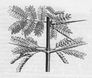
As another example of his skilled botanical drawing here is the Grapple Plant seed Uncaria procumbens (1:536) called Duiwelsklou.
*This reference* has a picture of the seed showing how accurate it is. *This reference* is CITES stating that it needs protection because the tubers are being dug up and sent to Germany where it is used to make medicine.
The medicinal uses of H. procumbens are numerous, it is used for the treatment of arteriosclerosis, gastro-intestinal problems, diabetes, hepatitis, and neuralgia. It also shows some indications for reduction of spasmodic blood pressure as well as positive effects on liver, gallbladder and kidney diseases (STÜBLER 1987, VOLK 1964, WATT & BREYERBRANDWIJK 1962, WENZEL & WEGENER 1995). The herb has potent anti-inflammatory characteristics and anti-arthritic activity with no notable side effects (ANON. 1998).
Burchell gives this picture of the pass they went through at Graaff-Reinet (on his earlier labour recruiting visit). Most of his pictures are to record what places looked like – similar to a photographic record. This is different as it is an artistic picture of the scenery. I have shown his portraits now add scenic pictures too.
Ouberg Pass (there are actually many passes with that name) is just after the Valley of Desolation and on the way to Nieu-Bethesda but it is not the same as what Burchell painted. From Burchell’s decription of it being the descent from the Sneeuberg I think it is most probably at Groot Hartebeesfontein farm on map 3124 or possibly Grootklip. Having ridden out to Nieu-Bethesda and now having a better idea of the countryside makes it easier to understand what Burchell has written.
The plaque at the top of Ouberg Pass lists T.G.Bain as one of the two engineers. Built in 1946 I wonder if he is part of the famous family that gave us the father & son engineers Andrew & Thomas.
I went looking for the six scenes Schumacher did of the Sneeuberg and Camdeboo. First I went up to Nieu-Bethesda to photograph Kompasberg as Burchell has an engraving. Then I went east looking for any of the six Schumacher scenes but found none. Next time I know I should go out towards Richmond – after all that is where the Sneeuberg are!
Luckily I had my Zumo as there are really no signs pointing to it. That is Kompasberg on the skyline.
Here I made a mistake. Wolweseun shows that he had a lovely light meal at the local micro brewery but I went to some place where I waited so long just to place an order that I walked out & went to the next place that does not sell beer. I must be one of the very few tourists to pass through Nieu-Bethesda without going to the Owl House. I would very much like to see it & the crushed glass ceilings. Wolweseun posted brilliant pictures of the Owl House in *the report I linked before*, but it seemed deserted when I rode past.
Burchell writes:
This is called by the colonists,Spitskop (The Peak) on account of its remarkably pointed form, by which it is distinguished as a great distance over all the surrounding country, as much as by its superior height. It has been in later years, very unnecessarily re-named Compasberg.
(2:125)After lunch I took the northern road towards the N9 (the southern one was closed – washed away?) which got me this.
This is not quite the right angle so I kept going & did get the correct view.
S 31° 50’ 51.7” E24° 36’ 47.9” but Burchell says he was 32km from it so I was in the right direction but closer (2:184). He made the sketch not on his labour recruiting trip but on leg of his trip I was now doing. I had followed his route quite accurately the day before but it was rainy and cloudy so I did not see it from 32 km away.
I then went looking for the sites of the Schumacher pictures of this area. There is an interesting gravel road that Burchell used when going to Graaff-Reinet in his wagon which follows the railway & Sondags river down towards Graaff-Reinet. I went down that until the road breaks away from the valley to join the N9 when I turned around & rode back up to the T-junction then went further east. Because I kept meeting the Sondags as I continued with this trip I have collected all the pictures into a separate post about the Sondags which I will post after the last crossing.
These are the seven pictures Schumacher made in this area. I suspect he rather liked the flat topped Karoo mountains – just as I do. Sadly he did not get to the glorious Kareeberg – I would love to seen his pictures of them. This one is labelled ‘View of the Sneeuwbergen at Van der Walt’
The following one labelled ‘View of the Sneeuwbergen as wild country’.
The next one is labelled ‘The Sneeuwbergen at Koeckmoer’
Next one ‘The Sneeuwbergen in Northern direction.’
Next one is labelled ‘In the Camdebo on the farm of Johannes Swanenpoel’.
The next one is labelled ‘The Camdebo Mountains seen from the Sneeuwbergen’
Finally there is ‘Hunt for Springbuck in the vicinity of Camdebo’. It is not obvious from this small picture but the whitish dots all across the veld are springbok on one of their mass migrations.
You can see the similarity in the form of the mountains but none of my pictures match Schumacher’s. It would be an interesting project to look for them all. I went east from Nieu-Bethesda partly because of time constraints & largely due to ignorance. The Sneeuberg is north and slightly west of Graaff-Reinet and Camdeboo is west so I was looking in the wrong place. Next time I will know where to look.
.
No comments:
Post a Comment