From Graaff-Reinet Burchell went to the Zuurveld (between Sundays & Great Fish rivers). The area known as Albany is part of the Zuurveld. This was 1813. The Fourth Xhosa War had just ended. I went there too but did not follow his route accurately but went to the same places.
Schumacher gives two pictures of Bruintjieshoogte. It is just before Somerset East. The first shows two wagons and two carts on the road beneath Bruintjieshoogte.
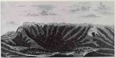
The second one is the continuation of the first.

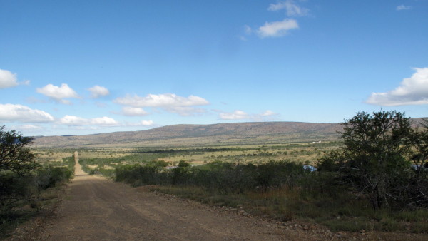
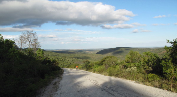
I forgot to look for the view but did take this picture.

Nice easy countryside like this for his wagon after Somerset East.
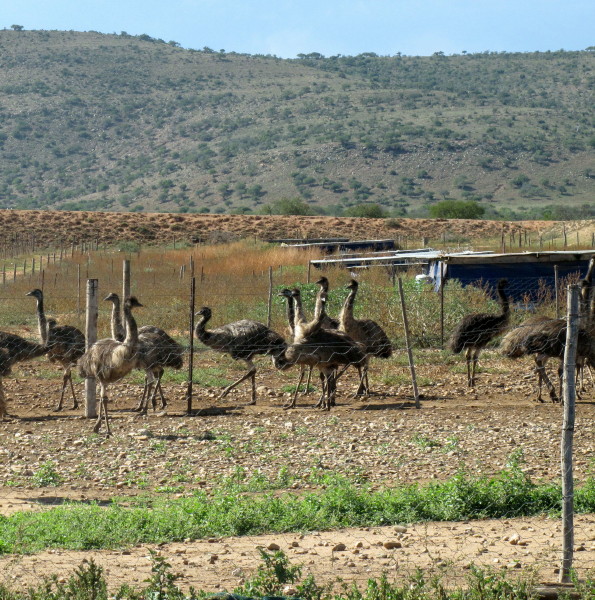
A bit further on I passed a long row of these coops with emus or rheas. What are they & what do they do with them?
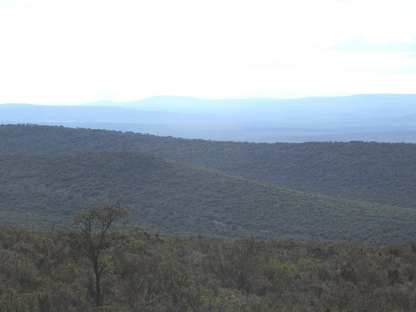
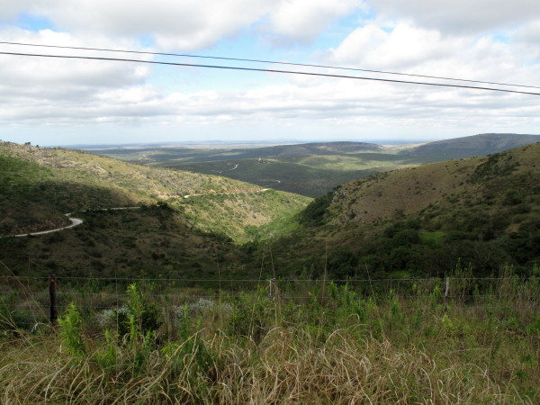
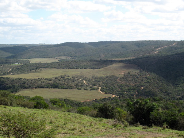
The road passed through the Zulu Game Reserve which seemed rather out of place. I didn’t see any game or Zulus. Then over a range of hills. What impressed me about the Eastern Cape was the vegetation. In the WC the mountainsides have been burned so frequently that they are almost naked & the plains are all under the plough.
My intention had been to go to Grahamstown & then follow Burchell’s clockwise route down to the Fish River mouth, Port Alfred and loop back to Grahamstown. T4A shows no camping in Grahamstown but a nice place upstream from Port Alfred so I decided to push straight through to Port Alfred on the short direct gravel road, nice to ride but more difficult for Burchell.
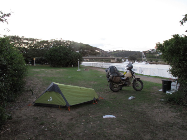
When I got to the campsite I found it is now a very upmarket security village – has been for years but T4A once again had it wrong. There is another campsite in town but close to the N2 so I was anticipating noise. In fact not too bad & it is a commercial operation so the showers etc. were spotless and the water hot. Beside the Kowie river with the bridge just visible.
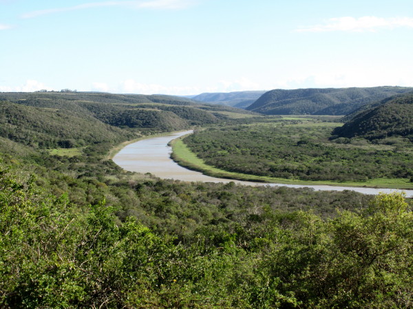
Next day I reversed what Burchell did. I went up to the Great Fish River then turned inland to Grahamstown. I have collected all my river pictures into a separate post which follows I repeat this one as I find the Eastern Cape rivers very attractive. We don’t have lovely river views like this in the WC. Great Fish close to the sea.
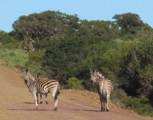
I met these zebra. They are the usual zebra (as against the less common Mountain Zebra), their proper name is Burchell’s Zebra Equus burchelli.
Further on field of young pineapples. With global warming I am expecting them to replace vines in the Western Cape.

There are some lovely areas to ride and nice roads in the Eastern Cape. Just be careful of Kudu at dusk and potholes everywhere. Fish river again.

I rode through a nice indigenous forest but I show this picture which shows more of the lovely landscape (pity about the wires).
There was no Grahamstown when Burchell passed through in September 1813. However he had a huge impact on the development of the town. After the Napoleonic wars, Britain experienced a serious unemployment problem. In June 1819 Burchell was called before the House of Commons Select Committee on the Poor Laws to advise on the suitability of South Africa for the settlement of British emigrants as he was the person in England with the most recent personal knowledge of conditions in the interior of Southern Africa. Burchell was there for three hours during which he strongly advocated that they be sent to the Albany district. My book includes a condensed transcript of that interview. Two weeks later the British Parliament voted £50 000 for assisting persons wanting to settle in the Eastern Cape.
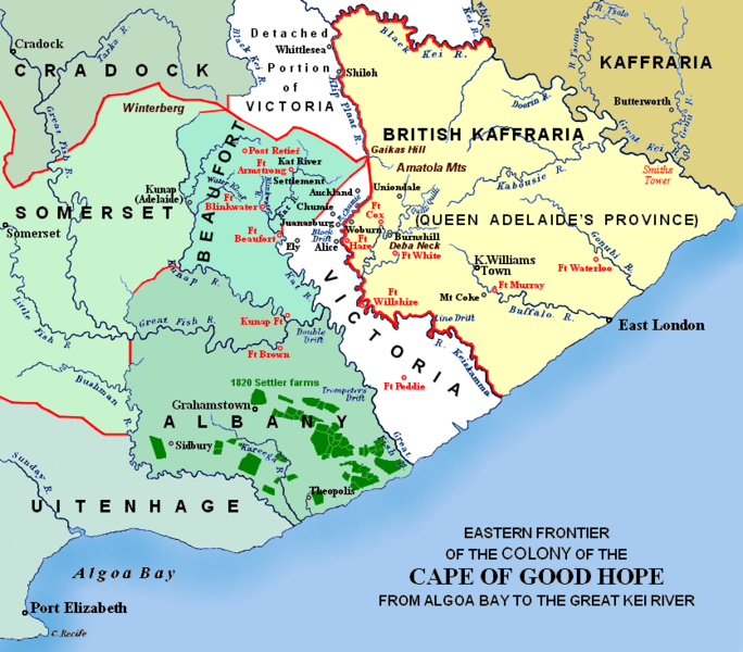
The British had taken over the Cape in 1806. One of the first concerns of the British overlords was to secure the eastern border of the colony, where the Xhosas had been driven back during the Fourth Frontier War in 1812. The governor of the Cape, Lord Charles Somerset, planned an agricultural settlement there as a ‘buffer’ between the Xhosas and the Cape Colony. This would reduce the need for the military to maintain the frontier. So the settlement scheme suited both the UK and the Cape.
This period saw one of the largest stages of British settlement in Africa, and approximately 4,000 Settlers arrived in the Cape, in around 60 different parties, between April and June 1820. The settlers were granted farms near the village of Bathurst, and supplied equipment and food against their deposits. A combination of factors caused many of the settlers to leave these farms for the surrounding towns. Firstly, many of the settlers were artisans with no interest in rural life, and lacked agricultural experience. In addition, life on the border was harsh and they suffered problems such as drought, rust conditions that affected crops, and a lack of transport. Therefore many settlers left the eastern border in search of a better life in towns such as Port Elizabeth, Grahamstown and East London. The eastern border therefore never became as densely populated as Somerset had hoped. The settlers who did remain as farmers made a significant contribution to agriculture, by planting maize, rye and barley. They also began wool farming which later became a very lucrative trade. Some of the settlers, who were traders by profession, also made a significant contribution to business and the economy. New towns such as Grahamstown and Port Elizabeth therefore grew rapidly.
*Source*This map shows in dark green where they were settled.
Burchell produced a pamphlet Hints on Emigration to the Cape of Good Hope. It is included in my Travels in the Interior of Southern Africa. It is sixteen pages; he starts with brief advice to those with money intent on going to the Cape but then gives advice to those without any money. Go to Albany as it is unoccupied & extremely fertile. He suggests that the immigrant be given seed to plant and flour as food plus some cattle and a tent. Spans of ploughing oxen should be available. Grahamstown had just been founded when he wrote these hints so he suggests it as a possible centre though he believed somewhere on the Kowie river much closer to the sea would be better. He writes about the need for a blacksmith, butcher, baker etc and also a priest and doctor for a successful community. He concludes by writing at length about expanding the colony up to the Gariep if more people emigrate than can be accommodated in Albany alone.
John Barrow (later Sir John) had been to South Africa before Burchell and had published a book with a title almost identical to that which Burchell used Travels into the Interior of Southern Africa 1801, 1804. Before Burchell he had been regarded as the greatest British traveller in South Africa so he probably resented that the younger Burchell was consulted by Parliament. For whatever reason he published a scathing attack on Burchell’s Hints saying amongst other things (1:i41):
He was, we understand, a “culler of simples”, and he certainly seems to have culled little else.
A small part of Barrow’s attack is included in my book. That bit is disingenuous as it states that Burchell recommended an inappropriate area behind the Sneeuberg and up at the Seekoei (Sea Cow) river. Barrow was a very influential man in British society, being the Permanent Secretary of the Admiralty for forty years when the Royal Navy was the most powerful on earth. He was a founder member of the Royal Geographical Society *Wiki on him*
Burchell then wrote a four page rejoinder (also included in my book) which includes (1:i43):
Before a writer comes forward to instruct the public, he should first instruct himself.
Which I take as a direct response to Barrow’s quote given above. Burchell then exposes the misrepresentation concerning the Seekoei river and sums up with (1:i45):
The vulgarity and malignity of his language present a true and faithful portrait of his mind. Take from him his pen, and he is nothing.
Powerful stuff. Extremely ill advised to write like that about so well connected a person as Sir John Barrow. This was in 1819. Burchell’s first volume came out in 1822 and the second in 1824. He took the opportunity to insert some further attacks on Barrow’s book in them. The books were ignored by the very influential Quarterly Review as that is where Barrow’s work had appeared and he was part of the editorial group. 750 copies of volume 1 were printed, that was reduced to 500 for volume 2 and volume 3 never appeared. Had Burchell not responded to Barrow’s stupid attack so virulently the success of his writing may have been greater and volume 3 may well have appeared. Burchell also missed his market by the books being very slow in appearing as he had returned to London in 1815 so the third volume would be at least 10 years after the event and other more recent travellers had books on the market by then (1:i14).
http://en.wikipedia.org/wiki/1820_Settlers
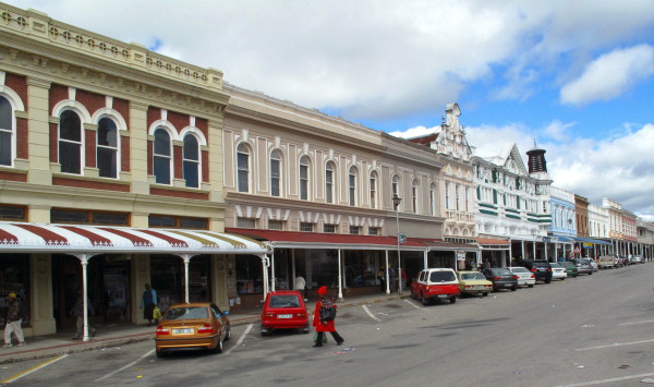
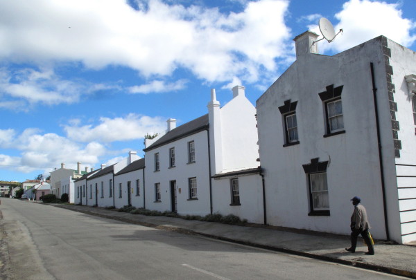
I got to Grahamstown. You probably know by now that I appreciate unspoiled streetscapes. This is exceptional. Allow one modern building here and the whole scene is destroyed.
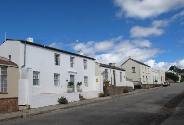
This is what Hans Fransen writes:
Much of all this has been well restored over recent decades, particularly since the appearance in 1963 of Ronald Lewcock’s book which is still the best study of Georgian and Regency architecture in this country. It makes ‘English’ Grahamstown a worthy counterpart to ‘Dutch’ Stellenbosch as the best-preserved old town in the entire Cape.
(Source: Hans Fransen Old Towns and Villages of the Cape 310).That coming from the author of The Old Buildings of the Cape which is largely responsible for the appreciation of Cape ‘Dutch’ architecture and the consequential preservation and restoration of those buildings and towns is high praise indeed.
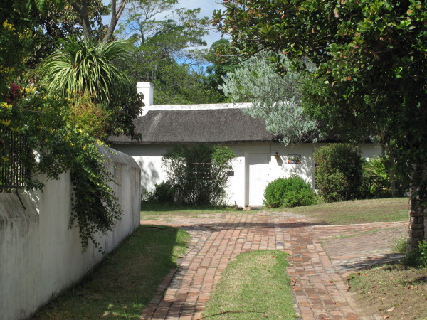
But what I was really looking for was this.
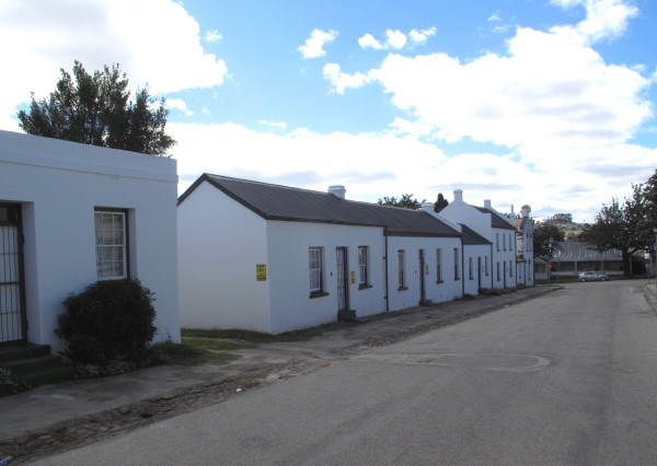
It may not impress you. It is called Artificers Square but Garmin does not know about it. Luckily I went to the excellent Red’s Cafe for late breakfast with Windhoek lager & asked there. The owner(?) did not know where it was but sms’d a friend who replied with the directions. It certainly is not a square. Those houses are original Settler’s houses. I enjoy modest as against grand houses so these I really liked.
They have not been tarted up by applying un-original pastel painted shutters and matching coloured doors, wine barrel flower boxes and fancy wrought iron lights like was done to Stretch’s Court. Just restored to more or less as they were (corrugated iron roofs in place of thatch so not restored to how they originally were). It is great that there are no telephone or electric poles, the pavement and kerb could be improved.
Unfortunately this one is set back from the road. It still has a thatch roof.
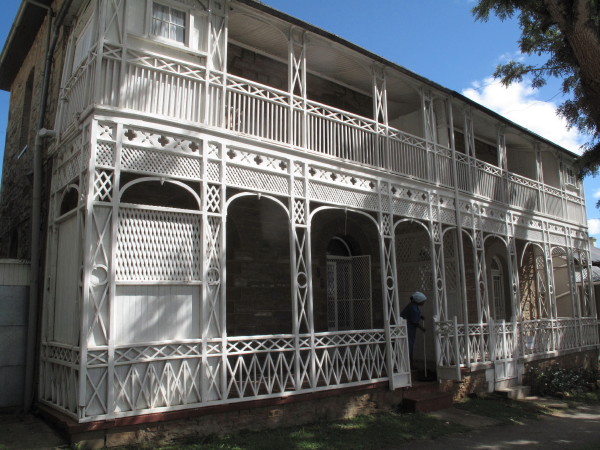
How about this? I love it.
From Grahamstown I wanted to go down to Salem; it is one of the small 1820 settlements complete with church. Burchell had passed that way. Again I was riding through the lovely Eastern Cape countryside. I understand why Burchell recommended it so highly.
The village has the oldest cricket pitch in the country. 1844. I did not realise it when I was there so I have found a much better picture on the web than the close ups I took of the church and parsonage in this picture. Church built 1832.

I smile because I had a real red Porsche 356A like that but I expect that is just a replica with VW engine. The cricket field is in the foreground.
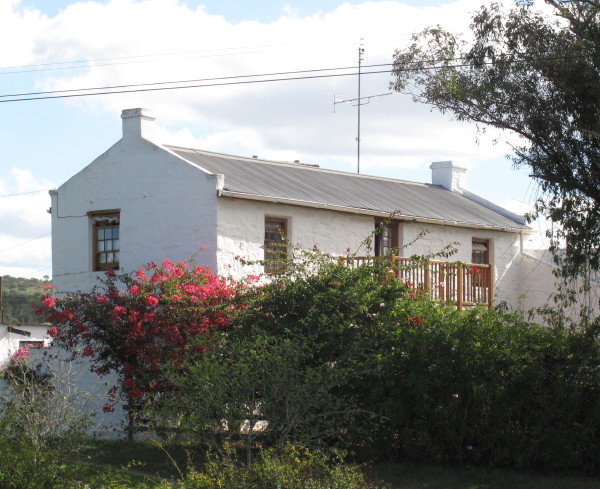
One of the houses in the village. It is stone built but the white paint disguises it.
This is the hotel. It is being very sensitively restored. The concrete pillars are going to be replaced.
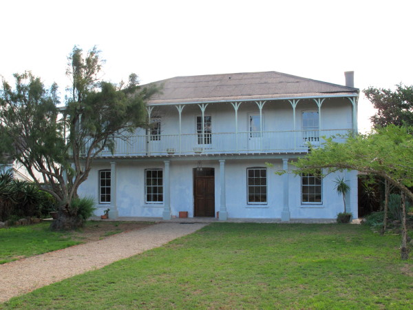
The contractor doing the restoration is a black man called Sam. He is building a nice business specialising in proper restoration of 1820 Settler era buildings. The front will be painted white with the plaster mouldings in a pale colour to emphasise them discreetly.


.
No comments:
Post a Comment