I have shown plenty of pictures of the Gariep and Vaal. Judging by the number of pictures I took of rivers on this trip they must have some significance to me. Here I want to collect some of those photos together. My first big ride on this bike was to follow the Sak river from its source to where it joins the Gariep; though it loses itself in the Grootvloer and the river that reappears is called the Hartbees. But that is a river of historical social significance; it is not much of a river actually.
*Sak River RR*
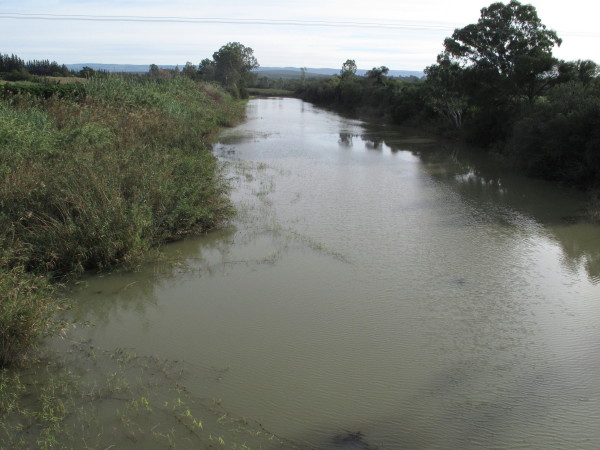
Sondags River
I have a lot of pictures of the Sondags because I kept meeting it. It is not much of a river really as you will see from these pictures – except right at the coast.
This map from the Department of Water Affairs shows how water from the Gariep runs through a tunnel to the headwaters of the Great Fish River then through two other canal & tunnel systems water is transferred to the Darlington Dam on the Sundays River. Finally some is pumped across to Port Elizabeth. PE is in such a water crises that they are now having to build a sea water desalination plant there costing R750 million. *source* . This is fearsomely expensive water, R8 per kl compared to R1 in Cape Town *source*.
*Source*
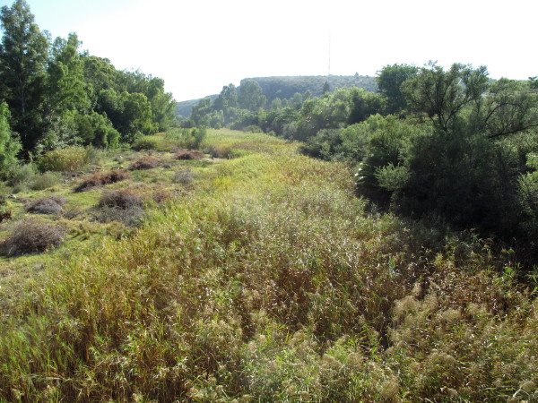
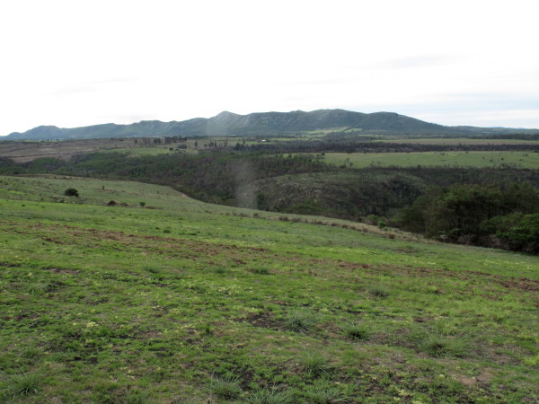
I have camped at the absolutely beautiful mouth of the Sondags and would be riding along it from Addo to Kirkwood so I thought it would be interesting to see how it grows in size. The map shows that the Sondags catchment area is north of Graaff-Reinet in the Sneeuberg. I crossed over the N9 after I had been to Nieu-Bethesda and followed the road alongside the railway line. They snake down alongside the Sondags river. The first time you cross it is just a stream.
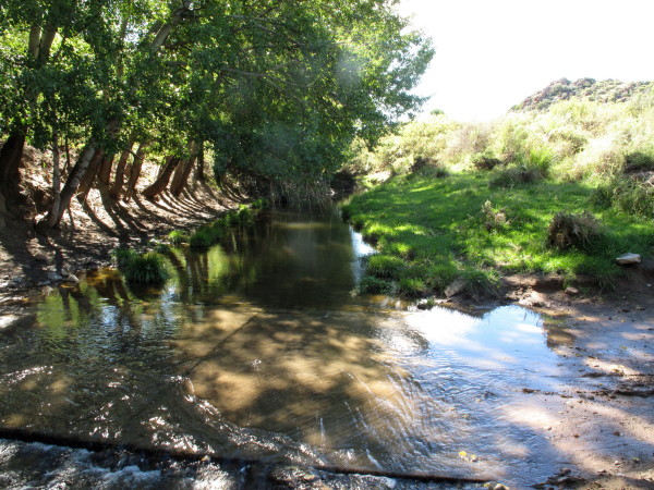
I crossed the river 10 times on this little piece going down towards the N9; then I turned around & went back up. The stream became wider and deeper as the valley became deeper. Burchell went down this valley to get to Graaff-Reinet with his wagon. I skipped it on my ride to G-R because time was running out & it was raining.
It is a lovely little ride. I think it would be a great ride to follow any of the bigger Eastern Cape rivers from source to sea.
The railway also wiggles down this valley.
When I got back to the T-junction near the start I went off again looking for Schumacher views.
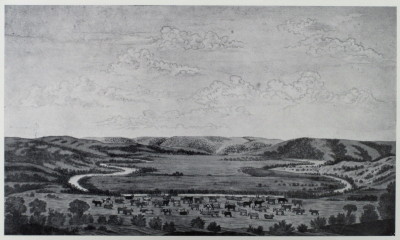
Graaff-Reinet is built inside a big loop in the river as shown by this picture by Wolweseun:
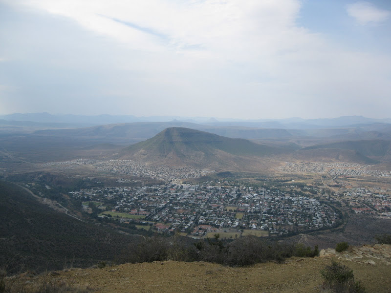
Graaff-Reinet seems to take little pleasure from having the river there as it is choked with riet. It could be made into a lovely winding park around the town if someone had a little imagination.
I crossed the canal bringing water from the Gariep to the Sondags just after leaving Somerset East – the Kookhouse tunnel ends at Uitkeer. I saw it but did not realise its significance so failed to take a picture. The water flows into the Little Fish and down to the De Mistkraal weir. Then it goes by canal to a small river flowing into the Darlington Dam on the Sundays River.
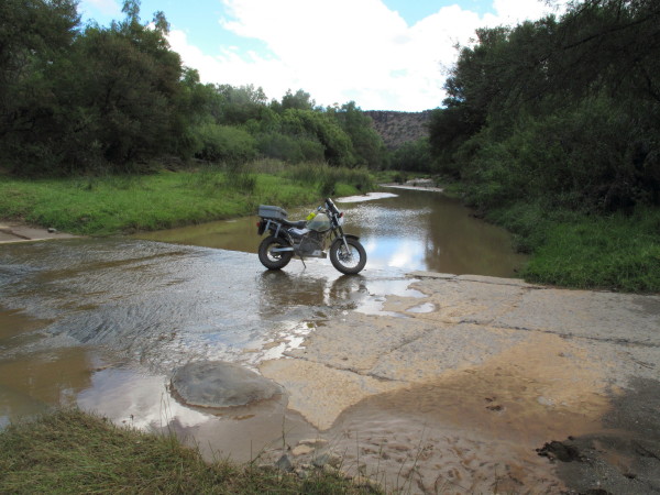
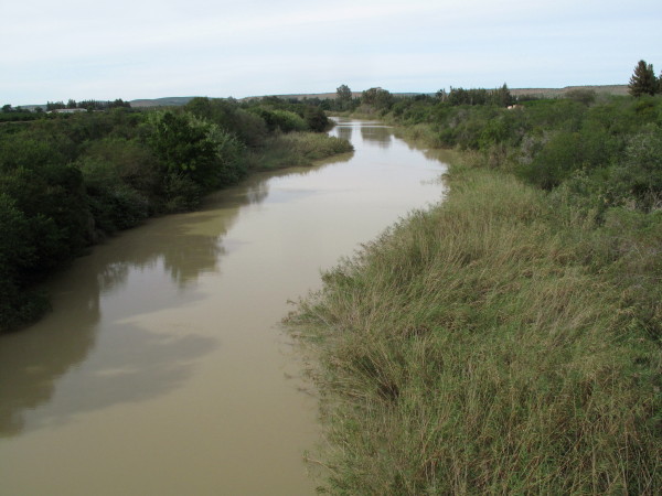
This is the Sondags downstream of the dam flowing towards Kirkwood.
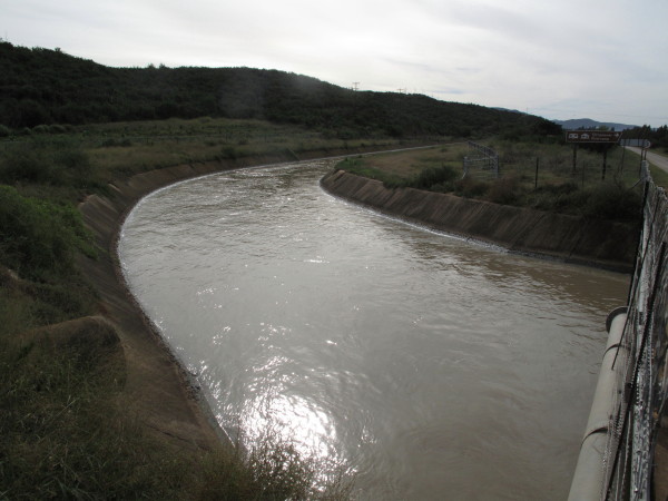
Upstream is the Korhaans weir with Kirkwood canal on E side of river. The first significant irrigation scheme in the country was built there in 1913. Kirkwood was the person who had the vision; by 1883 he had 21 farms there but when he tried to float a company on the Stock Exchange it failed because of the Great Depression. He died two years later. Sir Percy Fitzpatrick (Jock of the Bushveld) saw the potential here (after visiting the pioneer citrus farm) & invested. The irrigation scheme suffered due to both drought & flood but that was resolved when Lake Mentz (Darlington Dam) was built in 1922. (Bulpin p420). The water from the Gariep arrived in 1987 when the De Mistkraal Weir and canal were built on the Little Fish River. There is an excellent write up of the whole scheme *here*
I wanted to see the Kirkwood irrigated area as I had long known about it but never seen it. The Kirkwood irrigation canal.
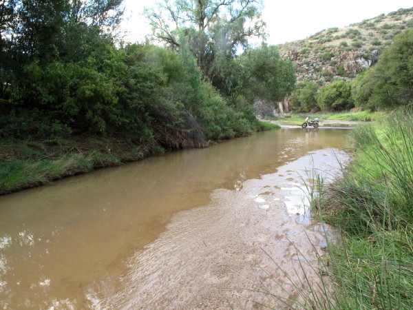
This is the river just before Addo village which is after the whole irrigation scheme.
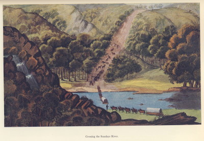
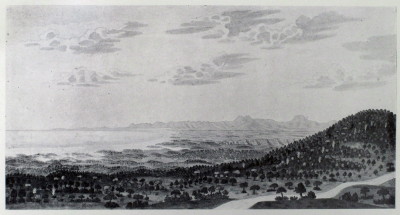
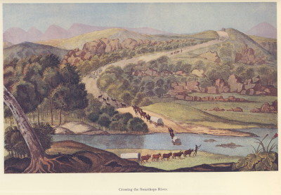
Le Vaillant ‘Crossing the Sundays River’. I did not look for this scene.
I first met Trailrider at the 2007 WD Bash in Hogsback and joined him and Snap Crackle Pop for their ride back. TR had arranged for us to camp at Colechester. This is what I wrote about it in my RR of that trip.
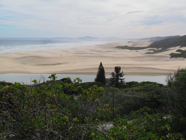
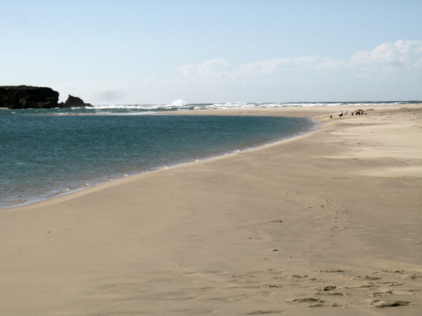
I was gobsmacked by the beauty of the place. Why? Because it is still the same as when Bartholomew Dias sailed past, still the same as when Mohammed walked this earth probably. Absolutely pristine. I am an old surfer & my favourite surf spot on the peninsula is Scarbourough because when you stand in the car park & check the break (point, not the beach break as the rip there kills me) you see not even a telegraph pole; there is nothing to show you that people have been around. It is a great wave to surf but that setting really makes a big difference to how I feel about the spot. (You can surf in the Cape Point Nature Reserve also & those spots are absolutely unspoiled but then you are not in an urban area. I salute Nature Conservation for permitting surfing there). Here is an estuary 30km from PE which is pristine; I had never imagined such a thing could exist.


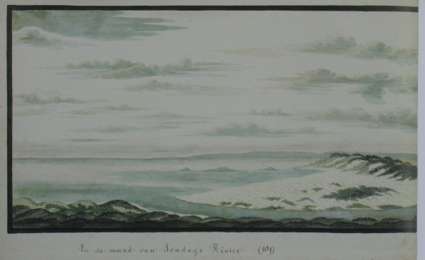
Schumacher did a panoramic picture of the estuary as two pictures. I have stitched them together.
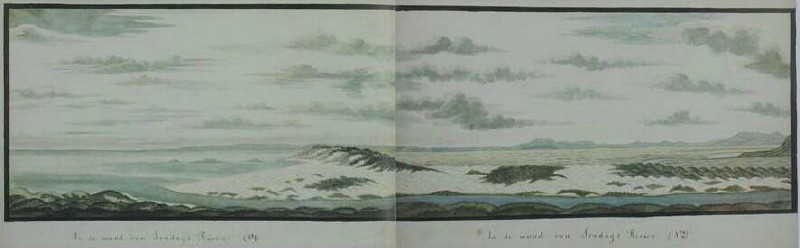
There is nowhere for Schumacher to have been to get this birds-eye view. He has created it so that he can better represent the locality. Here is the left hand portion by itself.
Van Stadens River
Schumacher did four pictures of the Van Stadens river. This is the most upstream picture looking inland (northwards).
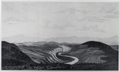
I took this picture from the N2 bridge looking downstream at the same part of the river.
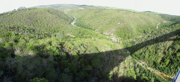
The old road and pass can be seen at the bottom. Slightly further upstream is the narrow gauge Apple Express railway bridge, *this* WD thread tells you how to get there – quite obscure. A very elegant steel trestle bridge.
This is the bridge I was standing on.
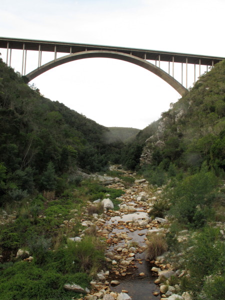
It was built in 1971 whereas the Storms River bridge was built in 1956. It is known as ‘Suicide Bridge’ .http://en.wikipedia.org/wiki/Van_Stadens_Bridge

Those Lifeline phones at each end of the bridge have been *misused a lot*, in March the *75th suicide* took place.
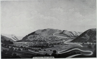
The next Schumacher picture shows a fork in the river. The map shows one upstream from the N2 road bridge. There is a red dashed road shown on map #3324 going to Sunnyside station on the narrow gauge railway. That road would be along the top of the hills in the background of this picture. The WD link I gave above probably describes how to get there.
This one is closer to the coast.

The Maitland River which is similar – it is the next river along from Van Stadens. When I took the picture I was riding upstream from the river mouth and I did not realise that I had crossed over to the Maitland river. There is no public road alongside the Van Stadens river. The 1:250 000 map #3324 shows a road to Yellowwood farm on the east bank which should give you a glimpse of the Schumacher view shown above. A similar bend on the Maitland river.
This is the river mouth.
The distant hills match; my point is that Schumacher painted accurately though his style was naive. I really like his naive paintings.
Fish River
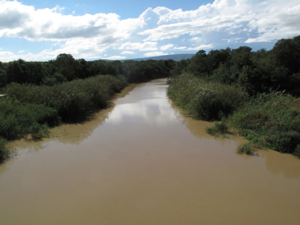
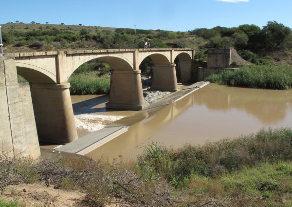
I saw the Great Fish River a few times. I think this would be a particularly good river to follow from source to mouth by bike. Downstream from Somerset East. Very muddy.
A bit further on is this handsome bridge. The arches are elegantly flat and the columns have an aesthetically pleasing rounded and tapering form with a capital like a Greek temple column. Today’s concrete bridges are purely functional but this has an aesthetic aspect as well. I wrote about several bridges in France *here*.
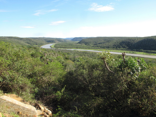
The hillside maintains its original well wooded covering making it a very special sight for someone from the Western Cape.

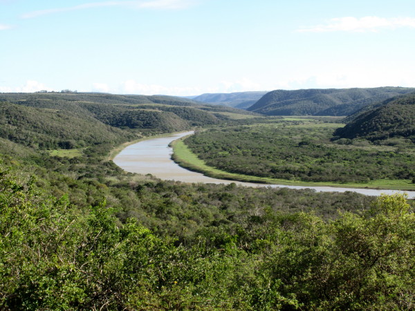
Getting down towards the coast. This is preserved because it is Kap River Nature Reserve on the left of the Fish River in this picture.
Right at the coast looking upstream. I was really impressed by how unspoiled much of the Eastern Cape is. Burchell would have seen pretty much the same scene. If this was in the Western Cape you would be looking at some ‘developers’ abomination – think of Still Bay.
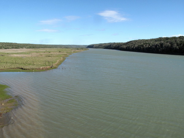
I rode down to the mouth and walked to the sea.
Amazon
Burchell visited a friend who had recently returned from an expedition to Brazil which resulted in him going there in 1825. It is probable that the publisher’s decision not to bring out the third volume was conveyed to Burchell when he delivered the second so Burchell was then free to travel again (i:i13). He was stuck in Rio de Janeiro for a year while he tried to get papers allowing him to travel overland across Peru, he did three local treks during this period. When the papers arrived he moved to Santos then trekked northwards to Goias (due west of present day Brasilia) where he stayed for nine months. He then heard that his father was ill so he abandoned the plan to travel through the jungle to Peru and instead went north to the mouth of the Amazon. He travelled down the Tocantins river which has lots of rapids and waterfalls. He had to wait eight months at Belem (then called Para but that is now the name of the state) before he could catch a boat to England. He was away for just over five years. His father had died by the time he got back. (1:i17). He brought back over 20 000 insect specimens from this trip. They together with his notes about them are at Oxford University now. All his plant specimens (SA & Brazil) and notes are at Kew Gardens. The journals he made during both of his travels have been lost.
He returned from Brazil in 1830 but, sadly, published nothing during the next 33 years. Burchell became an invalid and died by suicide in 1863 aged 82.
He was 29 when he arrived at the Cape. That trip lasted 5 years. He spent 10 years in the UK before going to Brazil when he was 44. He was again away for 5 years.
Kowie
I camped next to the Kowie in Port Alfred.

There is an interesting history to this place. I copy what Bulpin says. Burchell advocated that the settlers live alongside the river so that they could be serviced by seagoing ships – not as easy as he thought.
When the 1820 Settlers came to the Eastern Cape, they viewed the mouth of the Kowie with interest. At that time the estuary consisted of a swampy mixture of islets, canals and reeds confined east and west by the low hills known as the East and West banks. The area was entirely unpopulated and a great resort for birds and fish. Several individuals conceived the idea of a port at the mouth of the river. In 1821 the government, at their suggestion, sent a small brig, the Locust, to sound the entrance to the river, and this was the first vessel ever known to sail the waters of the Kowie. The bar across the entrance to the river varied from 1 m to over 2 m in depth, with reasonably deep water further inland. A rich fishing ground lay in the roadstead east of the river mouth close to the Fountain Rocks, so named on account of the swell which at high tide spouted up there in a jet of water. As a result of this investigation, Mr J Dyason was appointed pilot and harbour-master of the Kowie, a flagstaff was erected on the East Bank and a boat's crew appointed. This was the beginning of Port Kowie. A special light-draught schooner, the Elizabeth, was built to serve the port; and on 9 November 1821 this little vessel successfully entered the river. Unfortunately, on her next voyage from Port Elizabeth the schooner was totally wrecked on Cape Recife. Other coasters soon replaced the wreck, for there was a genuine need for a port to serve the Settler country. But, like all shallow river mouths, the Kowie was a death-trap for sailing vessels. A sudden drop in wind or an unexpected rush of tidal water could defeat the genius of any sailing master and land his vessel unceremoniously on the beach. For the next ten years the government struggled to develop Port Kowie into a harbour. The town which grew up on the banks of the river was at first called Port Frances in honour of the wife of Colonel Henry Somerset, son of the Governor, but in 1860 the name was finally changed to Port Alfred in honour of Prince Alfred who was on a visit to South Africa at the time. The efforts to develop a harbour failed. In 1831 the office of harbour-master was abolished and the port was left to a few fishermen and the enterprise of private individuals. Among these was William Cock who in 1836 settled there, building on the West Bank what became known as Cock's Castle. His daughter, Mary, has left her name on Mary's Cove. For years these private individuals laboured, trying a series of schemes to open the river mouth. Cock was the motivating force for most of these efforts and it was he who changed the flow of the river to a new channel below the West Bank. A vast amount of energy and money was expended on the Kowie by Cock and other people. Ships came and went, but the number that were wrecked was considerable and professional ship¬masters detested the place because of its dangers and uncertainties. The only saving grace was that Port Elizabeth, the nearest harbour, was also a great hazard to shipping. In 1857 the government once again launched a scheme to develop the port. Piers were built, a steam tug was stationed there in 1863 and a dredger employed in deepening the channel. A company, the Kowie Harbour Improvement Company, had the running of the port. This was the golden age of the harbour, with ships such as the 340 ton Icon trading there. Larger ships anchored in the roadstead and were serviced by lighters. In this way the mailships of the Union Steamship Navigation Company paid regular visits from 1875 onwards, with 101 ships landing 12 750 tons of cargo in Port Alfred in 1876. The year 1881 saw a great activity, with a railway being built from Port Alfred to Grahamstown. The constructional materials and rolling-stock were all shipped to the harbour. Included with this material was the steelwork for the 61 m high bridge over the Blaauwkranz where the railway dis¬aster took place in 1911. The railway was built by a private company, the Kowie Railway Company, which went into liquidation in 1886 and was taken over by another concern. It is interesting to know that two of the locomotives used on this railway are still preserved, one on a pedestal in the Cape Town railway station and the other in the Port Elizabeth Museum.
That locomotive in Cape Town Station is a National Monument. The Station has been redeveloped ready for the soccer WC. The locomotive has been illegally moved during the renovations. I don’t know if it has been put back or what has happened to it.
This is the entrance to the sea now. Rocks all the way out past the breakers so that it remains open all the time (no sandbar). Photo taken on the 2007 WD Bash trip.

I have pictures of some of the other rivers along the trip so i will include them here for completeness.
Swartkops
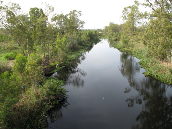
The Swartkops just downstream of Uitenhage. Looking upstream.
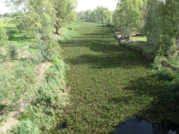
But looking downstream it is sad. Water hyacinth; from South America but a plague in Africa (& elsewhere). They have a weevil that does it some harm but nothing yet to keep it in check other than physically removing it.
Le Vaillant. Swartkops river crossing.
I don’t have the mountains in the background but Le Vaillant took liberties with his pictures (and writing).
This is at the same place as the other pictures just outside Uitenhage
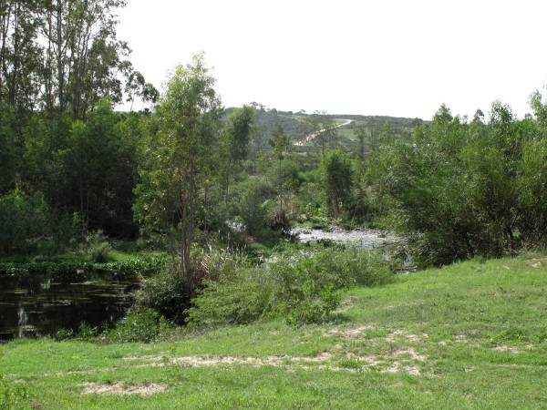
Gaurits
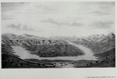
They look similar but Schumacher has the end of the Langeberg in the background. The river has several loops in this area at Herbertsdale.
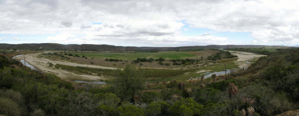
Bushmans
It is very similar to the Gaurits loop. The Bushmans is a very crinkly river but I did not see much of it
Very good description of sand problems at Bushmans http://www.brm.org.za/articles/Dredging%20Project%20Proposal.pdf
St Francis bay has huge problems caused by the buildings sitting on the sandfield. It is to prevent things like this happening that Environmental Impact assessments are required. http://www.asrltd.com/projects/st_francis_bay/
Gamtoos
This is the Gamtoos river with the N2 bridge in the distance.
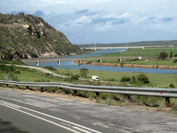
The bridge in the foreground is over 100 years old.
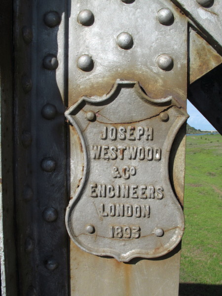
But ‘negative displacement’* (as I refer to BEE) has resulted in the loss of responsible and competent people. If you fail to do routine maintenance on a steel bridge (= cleaning & painting) it rusts. As you will see in the picture the main girders are almost completely rusted through at the overlaps.
*Note: I am a B.Sc Mech Eng. Positive displacement = a type of pump where the fluid is pushed away by a piston. My term is a play on that.
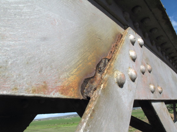
You need to look at this carefully; the main plate is rusted half way through and bent aside by the swelling rust.
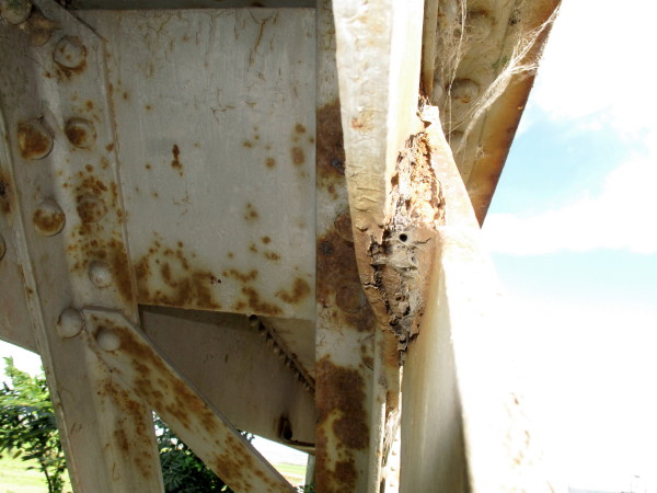
Too late to save it now in my opinion but will they even close it before it fails? The weakest link pretty well determines the overall strength of a structure like this.
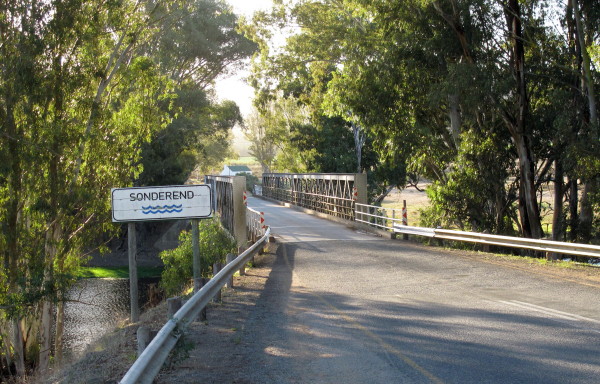
Sonderend
The river = Sonderend. The town = Riviersonderend. Map #3319 gives Riviesonderend. It is a bit like Onrust becoming Onrus. Burchell refers to it as the Zondereinde river (1:104 1:116). Even the town of Riviersonderend refers to the river as the Sonderend *see here*


.
No comments:
Post a Comment