Showing posts with label Adventure. Show all posts

Sunday, July 14, 2024

The Conclusion

Fast Forward to 2024.

Every year over the December holidays we choose a holiday car. We’ve had bikes, bakkies, SUVs and the like, but in spite of having such fit for purpose vehicles, when we decided to visit Gamkaskloof we did it with a Suzuki Ignis! This started off our Suzuki Adventures and since we have taken a Ignis to the Namakwaland Flowers, the Malgas Pontoon and several other places. We called it the Suzuki Adventures.

This year we had the newly launched Suzuki Fronx. All we needed was an adventure. And all these years, in the back of my mind, I remembered that Kliphuisie next to the river. How can you discover a place like that and not go stay there?

The plan was set, the accommodation booked and paid. To end off our holiday we’d spend three days and two nights on the bank of the Sonderendrivier.


How interesting to drive back on the same roads again, seeing what changed and what stayed the same. The derelict buildings deteriorated quite a bit over time.

And there it was, just as beautiful as all those years ago. I can’t believe it took me this long to come back.


I can't believe it took me this long to come back!


Cosy inside:

Daily visit from the garden service to mow the lawn.


Romantic evenings with no signal. No distractions. True rest.

A stop on the way out next to the same old building where I photographed the GWM H5 all those years ago.

And so, our holiday came to an end. As did the last chapter of the Vaandrigsdrif adventure.

It was time for the lovable Fronx to go back. We really enjoyed our time with this car. There may be much more Suzuki adventures in our future yet.


But for now, it’s back to work. Our first car for the year – the Mercedes A35 AMG. Life is tough when you are a motor journalist!


Tuesday, August 14, 2012

What is in a name?


Well, it's been a while since this little exploration started, but it was not forgotten. And as it happens another opportunity to go explore presented itself at last.

My wheels for today's journey was the aptly named Dodge Journey, a capable 3.6L V6 with enough ground clearance to handle anything today might throw at it. Also note how clean it is... for now.


Today I approached the area from a different direction, finding myself North of the Breede River traveling in an Easterly direction. In Beutler's day they would have been traveling East between the Breede and Zonderendriver, so that's where I needed to be. I crossed the Breede River on the R317 towards Stormsvlei, via the Red Iron Bridge:


The Red Iron bridge could easily be mistaken for a train bridge from a distance. It was built in the early 1900's, but apart from that I could not find any meaningful info on it. Structures like these have always fascinated me. Bridges connect people. Bridges provide safe passage over swollen rivers. Bridges allow the adventurer in you to go see what lies on the other side.


And today the Breede River was swollen, overflowing its banks after the recent rain:


The road hugs the Breede River traveling east, and even includes a little pass. It's not spectacular as far as Western Cape passes go, but there you have it - Hessekwasnek Pass:


Soon the road comes to a T-junction and right across you are presented with this:


Now I am pretty sure had Beutler's party come across this all those years ago, they would have stopped, and so did I. Wagon loaded with the newly acquired provisions I hit the road again.

The first gravel - you can see the earth is well and truly drenched at the moment.


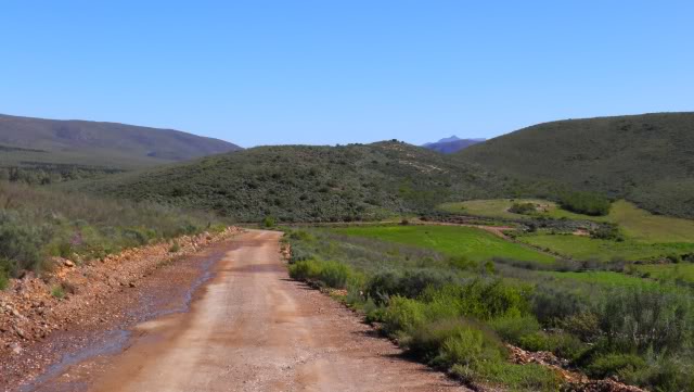
Some scenery of the winter landscape:


Once again, I did not have my T4A GPS, so I was merely following my nose with only a general idea of what direction I had to travel in.


Two roads diverged in the Overberg, and I, I took the one less traveled by...


And that has made all the difference!
(with apologies to Robert Frost)


Beginning to move down to the Zonderendriver valley.


The dense row of threes in the distance show where the river runs.


I stopped at the homestead to make my presence known, but no-one was home. I don't like being on some-ones land without permission, but the river was so painstakingly close now. I decided to drive the last couple of 100 meters to the river.


And there it was, overflowing its banks between the trees.


Here wagons had to camp for days waiting for the river to run down. And here I am, on the exact same spot.


The Breede and Zonderend rivers converge mere kilometers from here, with Swellendam being Northeast, and more importantly, North of the Breede river. I wonder why travelers on their way to Swellendam crossed the Zonderendriver to get to the Southern side, only to be confronted by a full Breede River 8km further on? Surely crossing the Breede river higher upstream would have been a better option? I makes little sense to me now, but I am sure they had their reasons back then.

Some more scenery on the way out:


And just as I thought my little adventure was over, I was confronted with the same problem Beutler had! An impassible route due to flooding!


While taking the photo a truck approached, weighed the options of taking the detour, and decided to go for it.


That didn't seem so bad? At least I know the bridge is intact. Should I chance it? Why not?


Well, let me give you some advice. When a road is closed, don't chance it! It's NOT worth it. I drove over the bridge, but the water was much higher / stronger / faster than I anticipated! A wall of water quickly formed next to the car, and I could feel the force of the water trying to push me off the bridge. I made it, through grace. Luckily, I was in a big car with reasonable clearance!

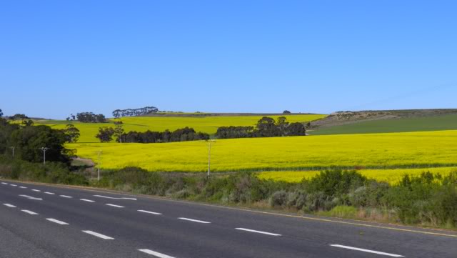
The rest of the journey home was spent looking at the Canola fields in full bloom and reflecting on what I have found.


What is in a name?


Juliet did not attach much importance to it, but in this case, there was more in a name I could have ever imagined. History, exploration, adventure. A name is the link of a place to it's past. I believe in traveling informed. It makes for a much richer travel experience and if you travel informed, a name is where your trip begins. So, Juliet, there is a lot in a name after all! When I first went to see what lay over that hill, some people would only have found a dead end, but because of the name, I now know that I stood where true explorers and adventurers once stood before. And that is very cool.

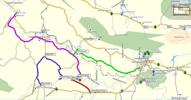
The last map of my travels:


But the adventure was not over yet...


Friday, April 13, 2012

What lies over that River?


Since my first little excursion in search of Vaandrigsdrif, my interest in the place and area went off the charts. I started doing more research and one fascinating fact led me to another.

Southern Africa has one of the longest records of human activity anywhere in the world. The Swellendam region in the Overberg is rich in historic sites dating from over 1 million years ago to more recent colonial settlements. The later Stone Age can be linked to the Khoi Khoi who, in the Swellendam region of the Overberg was known as the Hessequa. This name translated means “people of the trees”.

The Hessequa entered the Overberg region some 2,000 years ago. They were a clan of herders; farming fat tailed sheep and long horn cattle. The Hessequa’s moved freely across the western area of the Overberg and lived on the banks of the Breede River where they grazed their large herds.

Since my last visit things around here have been changing. The winter crops are starting to appear and the whole area is coming alive. As stated before my first photo was taken on the 1st of March 2012:


This was taken on the 13th of April. Just look at the change!


During the days of ensign Beutler this was one of the main routes from Cape Town to Swellendam. It crossed the Zonderendriver at a low-level crossing I located on a farm now called Vaandrighsdrift, on the other side of the river. Here wagons had to camp for days waiting for the river to run down only to be confronted by a full Breede River 8km further on.

Driving past the Vaandrigsdrif road sign and seeing the change every week I knew I needed to continue my search for the actual Vaandrigsdrif at the first possible opportunity. As it happens, today would be that day!

I was early again and had a couple of hours to spare. On top of that I had a suitable vehicle - a GWM H5. The car was sparkling clean (even the tyres were polished) so I had to get my photographs before I hit the gravel roads.


The "before" photo. I my opinion vehicles like these are for adventure, so it's not going to stay sparkling for long.

It might be a good idea at this stage to mention that this was not a planned event. The fact that my search continued today happened purely by chance. I have never been on the roads I was headed towards. I had no map and no off-road GPS, only a general idea of where I should be - the other side of the river! So, on my way back to George I took the R317 road off the N2 and crossed the Sonderend River near Stormsvlei.


This road meanders through the mountains via this poort and being is exploring mode I just had to stop for a pic.


The plains on the other side. It makes sense that travellers and explorers would have travelled here rather than on the Southern Side of the mountain range as the Flora here would have been less dense.


Some really scenic roads around here and surprisingly lots of derelict buildings and ruins.


Eventually the road I took wasn't even fenced off. Now I'm roaming free.


I stop at a farmstead to ask about the road towards the river and the friendly owners show me the way - look at this! They have a lovely stone house they rent out as self-catering accommodation.


It has a room with a double bed and place for the kids to sleep up top.


Nice fireplace and everything you need.


The house even has two fishing rods if you want to fish in the river. And what a spot!


This would make a perfect weekend getaway for the family.

It is not Vaandrigsdrif though. As it turns out Vaandrigdrif is further East, but what a beautiful area I find myself in.

Some more pics of this area:


I love this pic!


So, with all the stops and exploring and photos I used up all my available time and had to start heading back.


This is turning into quite an adventure. Where I ended up today: